You are here: Home > Network List > AK - Alaska Regional Network Stations List
> Station CUT Chulitna, AK, USA > Earthquake Result Viewer
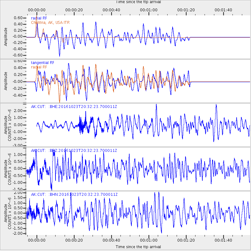
CUT Chulitna, AK, USA - Earthquake Result Viewer
*The percent match for this event was below the threshold and hence no stack was calculated.
| Earthquake location: |
East Of Kuril Islands |
| Earthquake latitude/longitude: |
44.0/148.2 |
| Earthquake time(UTC): |
2016/10/23 (297) 20:25:26 GMT |
| Earthquake Depth: |
30 km |
| Earthquake Magnitude: |
5.8 MB |
| Earthquake Catalog/Contributor: |
NEIC PDE/NEIC COMCAT |
|
| Network: |
AK Alaska Regional Network |
| Station: |
CUT Chulitna, AK, USA |
| Lat/Lon: |
62.41 N/150.26 W |
| Elevation: |
574 m |
|
| Distance: |
39.4 deg |
| Az: |
40.15 deg |
| Baz: |
271.638 deg |
| Ray Param: |
$rayparam |
*The percent match for this event was below the threshold and hence was not used in the summary stack. |
|
| Radial Match: |
66.59269 % |
| Radial Bump: |
358 |
| Transverse Match: |
59.198982 % |
| Transverse Bump: |
400 |
| SOD ConfigId: |
11737051 |
| Insert Time: |
2019-04-25 21:18:41.938 +0000 |
| GWidth: |
2.5 |
| Max Bumps: |
400 |
| Tol: |
0.001 |
|
Signal To Noise
| Channel | StoN | STA | LTA |
| AK:CUT: :BHZ:20161023T20:32:23.700011Z | 3.543979 | 6.3025675E-7 | 1.7783876E-7 |
| AK:CUT: :BHN:20161023T20:32:23.700011Z | 1.2005444 | 5.561666E-7 | 4.63262E-7 |
| AK:CUT: :BHE:20161023T20:32:23.700011Z | 2.1876738 | 8.4208426E-7 | 3.8492223E-7 |
| Arrivals |
| Ps | |
| PpPs | |
| PsPs/PpSs | |


