You are here: Home > Network List > AV - Alaska Volcano Observatory Stations List
> Station SPCN Ckakachatna North Broadband, Mount Spurr, Alaska > Earthquake Result Viewer
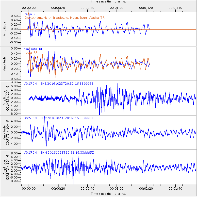
SPCN Ckakachatna North Broadband, Mount Spurr, Alaska - Earthquake Result Viewer
*The percent match for this event was below the threshold and hence no stack was calculated.
| Earthquake location: |
East Of Kuril Islands |
| Earthquake latitude/longitude: |
44.0/148.2 |
| Earthquake time(UTC): |
2016/10/23 (297) 20:25:26 GMT |
| Earthquake Depth: |
30 km |
| Earthquake Magnitude: |
5.8 MB |
| Earthquake Catalog/Contributor: |
NEIC PDE/NEIC COMCAT |
|
| Network: |
AV Alaska Volcano Observatory |
| Station: |
SPCN Ckakachatna North Broadband, Mount Spurr, Alaska |
| Lat/Lon: |
61.22 N/152.19 W |
| Elevation: |
735 m |
|
| Distance: |
38.5 deg |
| Az: |
42.073 deg |
| Baz: |
271.44 deg |
| Ray Param: |
$rayparam |
*The percent match for this event was below the threshold and hence was not used in the summary stack. |
|
| Radial Match: |
66.83565 % |
| Radial Bump: |
400 |
| Transverse Match: |
77.47987 % |
| Transverse Bump: |
400 |
| SOD ConfigId: |
11737051 |
| Insert Time: |
2019-04-25 21:20:33.834 +0000 |
| GWidth: |
2.5 |
| Max Bumps: |
400 |
| Tol: |
0.001 |
|
Signal To Noise
| Channel | StoN | STA | LTA |
| AV:SPCN: :BHZ:20161023T20:32:16.339995Z | 2.6659489 | 1.5928881E-6 | 5.9749385E-7 |
| AV:SPCN: :BHN:20161023T20:32:16.339995Z | 2.1654036 | 1.2976255E-6 | 5.992535E-7 |
| AV:SPCN: :BHE:20161023T20:32:16.339995Z | 2.0647593 | 1.4085978E-6 | 6.822092E-7 |
| Arrivals |
| Ps | |
| PpPs | |
| PsPs/PpSs | |


