You are here: Home > Network List > CI - Caltech Regional Seismic Network Stations List
> Station SHO Shoshone, CA, USA > Earthquake Result Viewer
SHO Shoshone, CA, USA - Earthquake Result Viewer
*The percent match for this event was below the threshold and hence no stack was calculated.
| Earthquake location: |
East Of Kuril Islands |
| Earthquake latitude/longitude: |
44.0/148.2 |
| Earthquake time(UTC): |
2016/10/23 (297) 20:25:26 GMT |
| Earthquake Depth: |
30 km |
| Earthquake Magnitude: |
5.8 MB |
| Earthquake Catalog/Contributor: |
NEIC PDE/NEIC COMCAT |
|
| Network: |
CI Caltech Regional Seismic Network |
| Station: |
SHO Shoshone, CA, USA |
| Lat/Lon: |
35.90 N/116.28 W |
| Elevation: |
451 m |
|
| Distance: |
69.7 deg |
| Az: |
59.506 deg |
| Baz: |
309.992 deg |
| Ray Param: |
$rayparam |
*The percent match for this event was below the threshold and hence was not used in the summary stack. |
|
| Radial Match: |
59.05102 % |
| Radial Bump: |
400 |
| Transverse Match: |
90.42809 % |
| Transverse Bump: |
400 |
| SOD ConfigId: |
11737051 |
| Insert Time: |
2019-04-25 21:22:22.036 +0000 |
| GWidth: |
2.5 |
| Max Bumps: |
400 |
| Tol: |
0.001 |
|
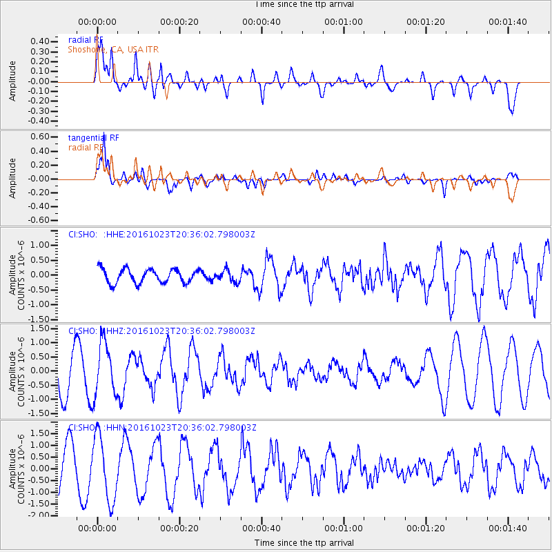
Signal To Noise
| Channel | StoN | STA | LTA |
| CI:SHO: :HHZ:20161023T20:36:02.798003Z | 1.2656937 | 9.2452217E-7 | 7.30447E-7 |
| CI:SHO: :HHN:20161023T20:36:02.798003Z | 1.5231996 | 1.4105368E-6 | 9.2603545E-7 |
| CI:SHO: :HHE:20161023T20:36:02.798003Z | 0.87443554 | 2.0486398E-7 | 2.342814E-7 |
| Arrivals |
| Ps | |
| PpPs | |
| PsPs/PpSs | |


