You are here: Home > Network List > CN - Canadian National Seismograph Network Stations List
> Station INK INUVIK, NT > Earthquake Result Viewer
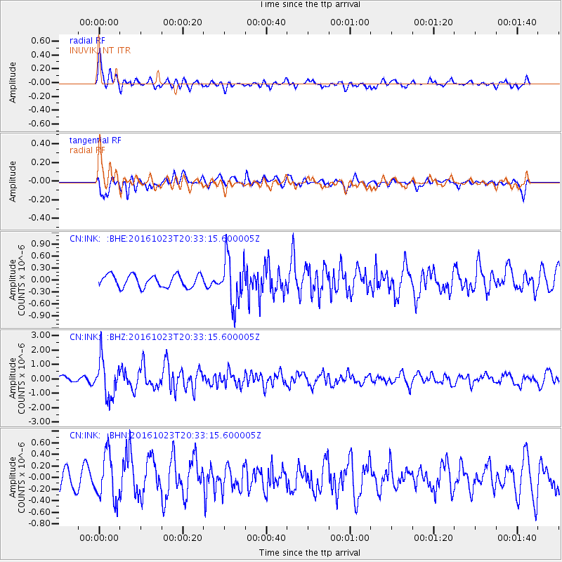
INK INUVIK, NT - Earthquake Result Viewer
*The percent match for this event was below the threshold and hence no stack was calculated.
| Earthquake location: |
East Of Kuril Islands |
| Earthquake latitude/longitude: |
44.0/148.2 |
| Earthquake time(UTC): |
2016/10/23 (297) 20:25:26 GMT |
| Earthquake Depth: |
30 km |
| Earthquake Magnitude: |
5.8 MB |
| Earthquake Catalog/Contributor: |
NEIC PDE/NEIC COMCAT |
|
| Network: |
CN Canadian National Seismograph Network |
| Station: |
INK INUVIK, NT |
| Lat/Lon: |
68.31 N/133.53 W |
| Elevation: |
44 m |
|
| Distance: |
45.8 deg |
| Az: |
30.503 deg |
| Baz: |
279.755 deg |
| Ray Param: |
$rayparam |
*The percent match for this event was below the threshold and hence was not used in the summary stack. |
|
| Radial Match: |
76.82592 % |
| Radial Bump: |
400 |
| Transverse Match: |
63.861668 % |
| Transverse Bump: |
400 |
| SOD ConfigId: |
11737051 |
| Insert Time: |
2019-04-25 21:22:55.419 +0000 |
| GWidth: |
2.5 |
| Max Bumps: |
400 |
| Tol: |
0.001 |
|
Signal To Noise
| Channel | StoN | STA | LTA |
| CN:INK: :BHZ:20161023T20:33:15.600005Z | 4.562774 | 1.3495048E-6 | 2.957641E-7 |
| CN:INK: :BHN:20161023T20:33:15.600005Z | 1.7103109 | 4.049922E-7 | 2.3679448E-7 |
| CN:INK: :BHE:20161023T20:33:15.600005Z | 3.9473186 | 6.0410207E-7 | 1.5304113E-7 |
| Arrivals |
| Ps | |
| PpPs | |
| PsPs/PpSs | |


