You are here: Home > Network List > IU - Global Seismograph Network (GSN - IRIS/USGS) Stations List
> Station HKT Hockley, Texas > Earthquake Result Viewer
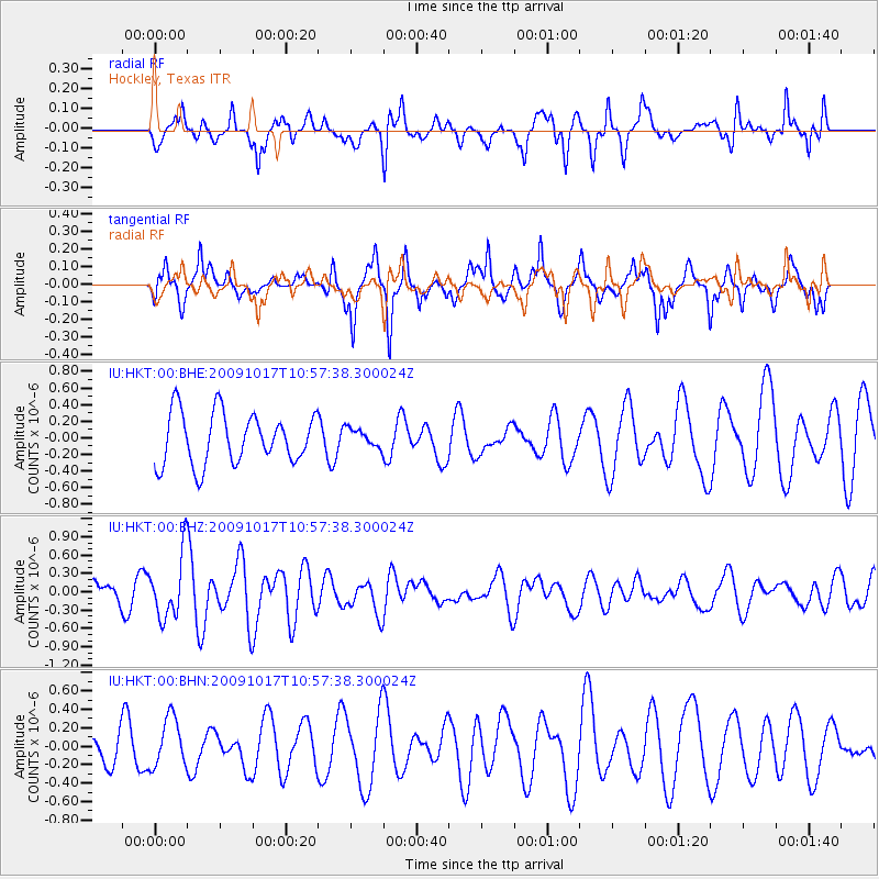
HKT Hockley, Texas - Earthquake Result Viewer
*The percent match for this event was below the threshold and hence no stack was calculated.
| Earthquake location: |
Samoa Islands Region |
| Earthquake latitude/longitude: |
-16.4/-172.0 |
| Earthquake time(UTC): |
2009/10/17 (290) 10:45:26 GMT |
| Earthquake Depth: |
10 km |
| Earthquake Magnitude: |
5.7 MB, 5.3 MS, 5.7 MW, 5.7 MW |
| Earthquake Catalog/Contributor: |
WHDF/NEIC |
|
| Network: |
IU Global Seismograph Network (GSN - IRIS/USGS) |
| Station: |
HKT Hockley, Texas |
| Lat/Lon: |
29.96 N/95.84 W |
| Elevation: |
-413.0 m |
|
| Distance: |
86.5 deg |
| Az: |
57.576 deg |
| Baz: |
249.032 deg |
| Ray Param: |
$rayparam |
*The percent match for this event was below the threshold and hence was not used in the summary stack. |
|
| Radial Match: |
57.41308 % |
| Radial Bump: |
323 |
| Transverse Match: |
50.09281 % |
| Transverse Bump: |
301 |
| SOD ConfigId: |
1 |
| Insert Time: |
2010-02-19 00:51:07.603 +0000 |
| GWidth: |
2.5 |
| Max Bumps: |
400 |
| Tol: |
0.001 |
|
Signal To Noise
| Channel | StoN | STA | LTA |
| IU:HKT:00:BHZ:20091017T10:57:38.300024Z | 2.939358 | 5.225883E-7 | 1.7778994E-7 |
| IU:HKT:00:BHN:20091017T10:57:38.300024Z | 1.4054724 | 2.697938E-7 | 1.919595E-7 |
| IU:HKT:00:BHE:20091017T10:57:38.300024Z | 0.35616577 | 1.0918943E-7 | 3.0656912E-7 |
| Arrivals |
| Ps | |
| PpPs | |
| PsPs/PpSs | |


