You are here: Home > Network List > TA - USArray Transportable Network (new EarthScope stations) Stations List
> Station A36M Sachs Harbour, NT, CAN > Earthquake Result Viewer
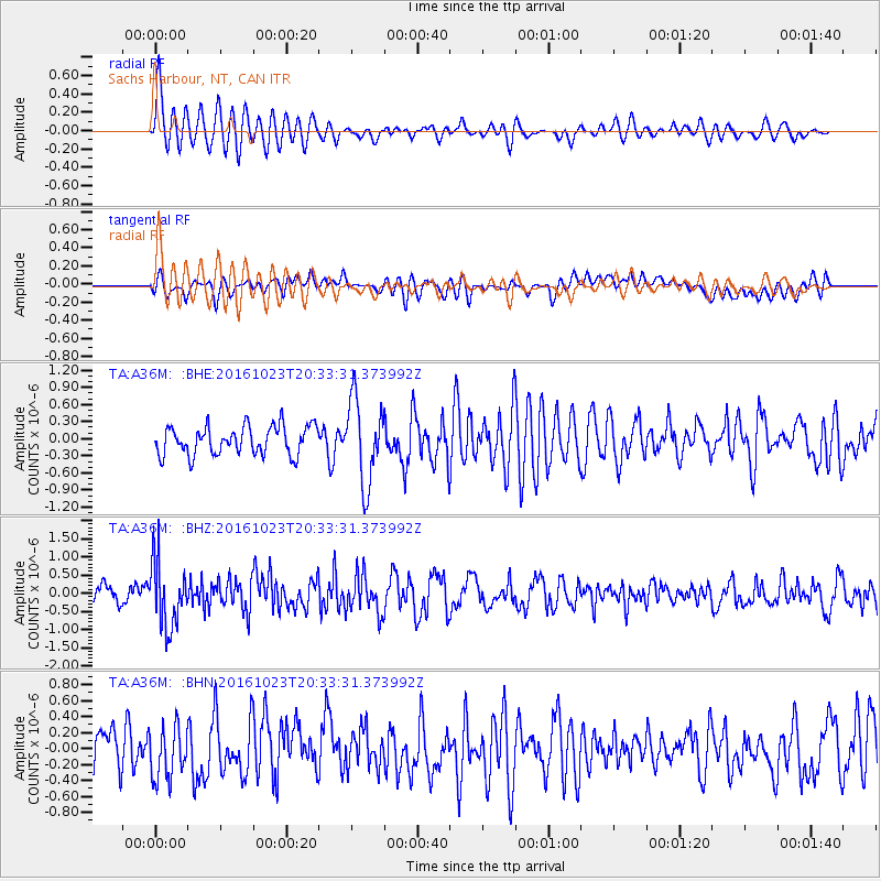
A36M Sachs Harbour, NT, CAN - Earthquake Result Viewer
*The percent match for this event was below the threshold and hence no stack was calculated.
| Earthquake location: |
East Of Kuril Islands |
| Earthquake latitude/longitude: |
44.0/148.2 |
| Earthquake time(UTC): |
2016/10/23 (297) 20:25:26 GMT |
| Earthquake Depth: |
30 km |
| Earthquake Magnitude: |
5.8 MB |
| Earthquake Catalog/Contributor: |
NEIC PDE/NEIC COMCAT |
|
| Network: |
TA USArray Transportable Network (new EarthScope stations) |
| Station: |
A36M Sachs Harbour, NT, CAN |
| Lat/Lon: |
71.99 N/125.25 W |
| Elevation: |
32 m |
|
| Distance: |
47.9 deg |
| Az: |
24.763 deg |
| Baz: |
283.613 deg |
| Ray Param: |
$rayparam |
*The percent match for this event was below the threshold and hence was not used in the summary stack. |
|
| Radial Match: |
71.25077 % |
| Radial Bump: |
400 |
| Transverse Match: |
39.75068 % |
| Transverse Bump: |
400 |
| SOD ConfigId: |
11737051 |
| Insert Time: |
2019-04-25 21:30:38.632 +0000 |
| GWidth: |
2.5 |
| Max Bumps: |
400 |
| Tol: |
0.001 |
|
Signal To Noise
| Channel | StoN | STA | LTA |
| TA:A36M: :BHZ:20161023T20:33:31.373992Z | 4.2776794 | 9.049867E-7 | 2.1156019E-7 |
| TA:A36M: :BHN:20161023T20:33:31.373992Z | 0.89344966 | 3.131794E-7 | 3.5052835E-7 |
| TA:A36M: :BHE:20161023T20:33:31.373992Z | 2.9312294 | 7.338329E-7 | 2.5034987E-7 |
| Arrivals |
| Ps | |
| PpPs | |
| PsPs/PpSs | |


