You are here: Home > Network List > TA - USArray Transportable Network (new EarthScope stations) Stations List
> Station G21K Allakaket, AK, USA > Earthquake Result Viewer
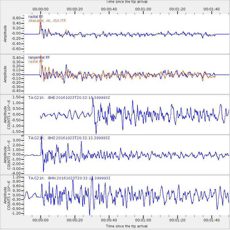
G21K Allakaket, AK, USA - Earthquake Result Viewer
*The percent match for this event was below the threshold and hence no stack was calculated.
| Earthquake location: |
East Of Kuril Islands |
| Earthquake latitude/longitude: |
44.0/148.2 |
| Earthquake time(UTC): |
2016/10/23 (297) 20:25:26 GMT |
| Earthquake Depth: |
30 km |
| Earthquake Magnitude: |
5.8 MB |
| Earthquake Catalog/Contributor: |
NEIC PDE/NEIC COMCAT |
|
| Network: |
TA USArray Transportable Network (new EarthScope stations) |
| Station: |
G21K Allakaket, AK, USA |
| Lat/Lon: |
66.52 N/153.51 W |
| Elevation: |
446 m |
|
| Distance: |
38.2 deg |
| Az: |
33.476 deg |
| Baz: |
263.51 deg |
| Ray Param: |
$rayparam |
*The percent match for this event was below the threshold and hence was not used in the summary stack. |
|
| Radial Match: |
76.847336 % |
| Radial Bump: |
400 |
| Transverse Match: |
70.21283 % |
| Transverse Bump: |
400 |
| SOD ConfigId: |
11737051 |
| Insert Time: |
2019-04-25 21:30:56.023 +0000 |
| GWidth: |
2.5 |
| Max Bumps: |
400 |
| Tol: |
0.001 |
|
Signal To Noise
| Channel | StoN | STA | LTA |
| TA:G21K: :BHZ:20161023T20:32:13.399993Z | 8.900995 | 1.485836E-6 | 1.669292E-7 |
| TA:G21K: :BHN:20161023T20:32:13.399993Z | 1.6188804 | 3.12178E-7 | 1.9283574E-7 |
| TA:G21K: :BHE:20161023T20:32:13.399993Z | 3.9254992 | 7.1982754E-7 | 1.8337222E-7 |
| Arrivals |
| Ps | |
| PpPs | |
| PsPs/PpSs | |


