You are here: Home > Network List > TA - USArray Transportable Network (new EarthScope stations) Stations List
> Station J25K Salcha River, AK, USA > Earthquake Result Viewer
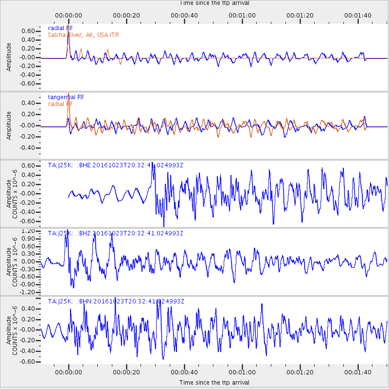
J25K Salcha River, AK, USA - Earthquake Result Viewer
*The percent match for this event was below the threshold and hence no stack was calculated.
| Earthquake location: |
East Of Kuril Islands |
| Earthquake latitude/longitude: |
44.0/148.2 |
| Earthquake time(UTC): |
2016/10/23 (297) 20:25:26 GMT |
| Earthquake Depth: |
30 km |
| Earthquake Magnitude: |
5.8 MB |
| Earthquake Catalog/Contributor: |
NEIC PDE/NEIC COMCAT |
|
| Network: |
TA USArray Transportable Network (new EarthScope stations) |
| Station: |
J25K Salcha River, AK, USA |
| Lat/Lon: |
64.61 N/145.37 W |
| Elevation: |
949 m |
|
| Distance: |
41.5 deg |
| Az: |
36.596 deg |
| Baz: |
273.308 deg |
| Ray Param: |
$rayparam |
*The percent match for this event was below the threshold and hence was not used in the summary stack. |
|
| Radial Match: |
69.65267 % |
| Radial Bump: |
400 |
| Transverse Match: |
69.72206 % |
| Transverse Bump: |
400 |
| SOD ConfigId: |
11737051 |
| Insert Time: |
2019-04-25 21:31:13.088 +0000 |
| GWidth: |
2.5 |
| Max Bumps: |
400 |
| Tol: |
0.001 |
|
Signal To Noise
| Channel | StoN | STA | LTA |
| TA:J25K: :BHZ:20161023T20:32:41.024993Z | 5.351729 | 6.014726E-7 | 1.1238847E-7 |
| TA:J25K: :BHN:20161023T20:32:41.024993Z | 1.1429266 | 1.7530647E-7 | 1.5338384E-7 |
| TA:J25K: :BHE:20161023T20:32:41.024993Z | 4.560255 | 3.6046853E-7 | 7.904569E-8 |
| Arrivals |
| Ps | |
| PpPs | |
| PsPs/PpSs | |


