You are here: Home > Network List > TA - USArray Transportable Network (new EarthScope stations) Stations List
> Station L19K White Mountain, AK, USA > Earthquake Result Viewer
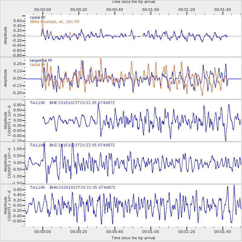
L19K White Mountain, AK, USA - Earthquake Result Viewer
*The percent match for this event was below the threshold and hence no stack was calculated.
| Earthquake location: |
East Of Kuril Islands |
| Earthquake latitude/longitude: |
44.0/148.2 |
| Earthquake time(UTC): |
2016/10/23 (297) 20:25:26 GMT |
| Earthquake Depth: |
30 km |
| Earthquake Magnitude: |
5.8 MB |
| Earthquake Catalog/Contributor: |
NEIC PDE/NEIC COMCAT |
|
| Network: |
TA USArray Transportable Network (new EarthScope stations) |
| Station: |
L19K White Mountain, AK, USA |
| Lat/Lon: |
62.18 N/154.85 W |
| Elevation: |
650 m |
|
| Distance: |
37.3 deg |
| Az: |
40.497 deg |
| Baz: |
267.85 deg |
| Ray Param: |
$rayparam |
*The percent match for this event was below the threshold and hence was not used in the summary stack. |
|
| Radial Match: |
62.94939 % |
| Radial Bump: |
400 |
| Transverse Match: |
52.283043 % |
| Transverse Bump: |
400 |
| SOD ConfigId: |
11737051 |
| Insert Time: |
2019-04-25 21:31:21.188 +0000 |
| GWidth: |
2.5 |
| Max Bumps: |
400 |
| Tol: |
0.001 |
|
Signal To Noise
| Channel | StoN | STA | LTA |
| TA:L19K: :BHZ:20161023T20:32:05.674987Z | 3.2992368 | 6.78515E-7 | 2.0565818E-7 |
| TA:L19K: :BHN:20161023T20:32:05.674987Z | 0.8198445 | 2.3435553E-7 | 2.8585364E-7 |
| TA:L19K: :BHE:20161023T20:32:05.674987Z | 2.4070425 | 4.7408892E-7 | 1.969591E-7 |
| Arrivals |
| Ps | |
| PpPs | |
| PsPs/PpSs | |


