You are here: Home > Network List > TA - USArray Transportable Network (new EarthScope stations) Stations List
> Station MDND Maddock, ND, USA > Earthquake Result Viewer
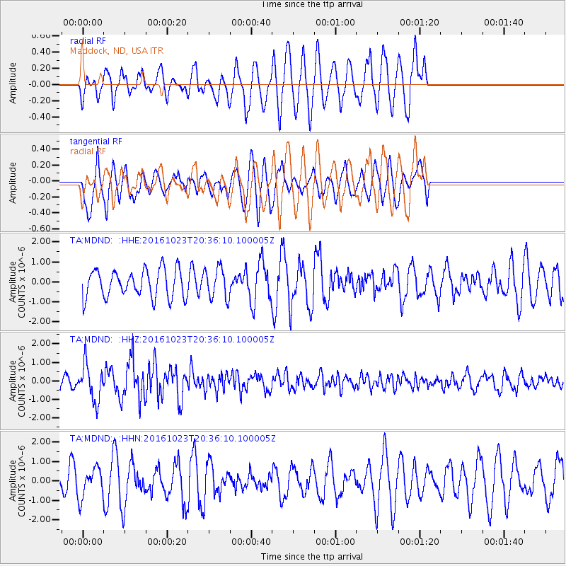
MDND Maddock, ND, USA - Earthquake Result Viewer
*The percent match for this event was below the threshold and hence no stack was calculated.
| Earthquake location: |
East Of Kuril Islands |
| Earthquake latitude/longitude: |
44.0/148.2 |
| Earthquake time(UTC): |
2016/10/23 (297) 20:25:26 GMT |
| Earthquake Depth: |
30 km |
| Earthquake Magnitude: |
5.8 MB |
| Earthquake Catalog/Contributor: |
NEIC PDE/NEIC COMCAT |
|
| Network: |
TA USArray Transportable Network (new EarthScope stations) |
| Station: |
MDND Maddock, ND, USA |
| Lat/Lon: |
47.85 N/99.60 W |
| Elevation: |
479 m |
|
| Distance: |
70.9 deg |
| Az: |
41.29 deg |
| Baz: |
314.992 deg |
| Ray Param: |
$rayparam |
*The percent match for this event was below the threshold and hence was not used in the summary stack. |
|
| Radial Match: |
50.626724 % |
| Radial Bump: |
400 |
| Transverse Match: |
34.228806 % |
| Transverse Bump: |
354 |
| SOD ConfigId: |
11737051 |
| Insert Time: |
2019-04-25 21:31:32.875 +0000 |
| GWidth: |
2.5 |
| Max Bumps: |
400 |
| Tol: |
0.001 |
|
Signal To Noise
| Channel | StoN | STA | LTA |
| TA:MDND: :HHZ:20161023T20:36:10.100005Z | 5.3457265 | 9.914693E-7 | 1.8546952E-7 |
| TA:MDND: :HHN:20161023T20:36:10.100005Z | 0.8808417 | 7.578213E-7 | 8.6033765E-7 |
| TA:MDND: :HHE:20161023T20:36:10.100005Z | 1.1129 | 7.7820437E-7 | 6.992581E-7 |
| Arrivals |
| Ps | |
| PpPs | |
| PsPs/PpSs | |


