You are here: Home > Network List > TA - USArray Transportable Network (new EarthScope stations) Stations List
> Station T25A Trinidad, CO, USA > Earthquake Result Viewer
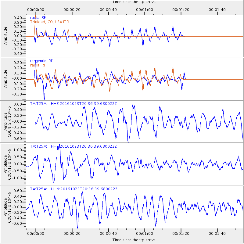
T25A Trinidad, CO, USA - Earthquake Result Viewer
*The percent match for this event was below the threshold and hence no stack was calculated.
| Earthquake location: |
East Of Kuril Islands |
| Earthquake latitude/longitude: |
44.0/148.2 |
| Earthquake time(UTC): |
2016/10/23 (297) 20:25:26 GMT |
| Earthquake Depth: |
30 km |
| Earthquake Magnitude: |
5.8 MB |
| Earthquake Catalog/Contributor: |
NEIC PDE/NEIC COMCAT |
|
| Network: |
TA USArray Transportable Network (new EarthScope stations) |
| Station: |
T25A Trinidad, CO, USA |
| Lat/Lon: |
37.14 N/104.41 W |
| Elevation: |
2017 m |
|
| Distance: |
75.9 deg |
| Az: |
51.818 deg |
| Baz: |
314.759 deg |
| Ray Param: |
$rayparam |
*The percent match for this event was below the threshold and hence was not used in the summary stack. |
|
| Radial Match: |
74.03067 % |
| Radial Bump: |
400 |
| Transverse Match: |
70.89447 % |
| Transverse Bump: |
400 |
| SOD ConfigId: |
11737051 |
| Insert Time: |
2019-04-25 21:32:06.679 +0000 |
| GWidth: |
2.5 |
| Max Bumps: |
400 |
| Tol: |
0.001 |
|
Signal To Noise
| Channel | StoN | STA | LTA |
| TA:T25A: :HHZ:20161023T20:36:39.680022Z | 2.9699085 | 5.413727E-7 | 1.8228599E-7 |
| TA:T25A: :HHN:20161023T20:36:39.680022Z | 1.1860828 | 2.7540253E-7 | 2.3219502E-7 |
| TA:T25A: :HHE:20161023T20:36:39.680022Z | 2.4956634 | 3.6028837E-7 | 1.4436577E-7 |
| Arrivals |
| Ps | |
| PpPs | |
| PsPs/PpSs | |


