You are here: Home > Network List > CI - Caltech Regional Seismic Network Stations List
> Station BAR Barrett, Tecate, CA, USA > Earthquake Result Viewer
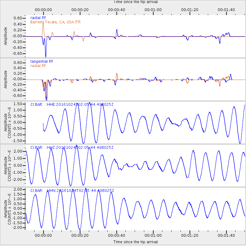
BAR Barrett, Tecate, CA, USA - Earthquake Result Viewer
*The percent match for this event was below the threshold and hence no stack was calculated.
| Earthquake location: |
Southeast Of Easter Island |
| Earthquake latitude/longitude: |
-36.0/-102.7 |
| Earthquake time(UTC): |
2016/10/24 (298) 01:55:06 GMT |
| Earthquake Depth: |
10 km |
| Earthquake Magnitude: |
5.5 Mwb |
| Earthquake Catalog/Contributor: |
NEIC PDE/us |
|
| Network: |
CI Caltech Regional Seismic Network |
| Station: |
BAR Barrett, Tecate, CA, USA |
| Lat/Lon: |
32.68 N/116.67 W |
| Elevation: |
521 m |
|
| Distance: |
69.6 deg |
| Az: |
347.439 deg |
| Baz: |
167.93 deg |
| Ray Param: |
$rayparam |
*The percent match for this event was below the threshold and hence was not used in the summary stack. |
|
| Radial Match: |
92.227745 % |
| Radial Bump: |
252 |
| Transverse Match: |
94.618774 % |
| Transverse Bump: |
257 |
| SOD ConfigId: |
11737051 |
| Insert Time: |
2019-04-25 21:38:54.118 +0000 |
| GWidth: |
2.5 |
| Max Bumps: |
400 |
| Tol: |
0.001 |
|
Signal To Noise
| Channel | StoN | STA | LTA |
| CI:BAR: :HHZ:20161024T02:05:44.498025Z | 1.2060728 | 1.7281834E-6 | 1.4329014E-6 |
| CI:BAR: :HHN:20161024T02:05:44.498025Z | 1.4934886 | 1.3154067E-6 | 8.807612E-7 |
| CI:BAR: :HHE:20161024T02:05:44.498025Z | 1.2365154 | 1.0732127E-6 | 8.679331E-7 |
| Arrivals |
| Ps | |
| PpPs | |
| PsPs/PpSs | |


