You are here: Home > Network List > CI - Caltech Regional Seismic Network Stations List
> Station FMP Fort MacArthur Park, Pt. Fermin San Pedro, CA, USA > Earthquake Result Viewer
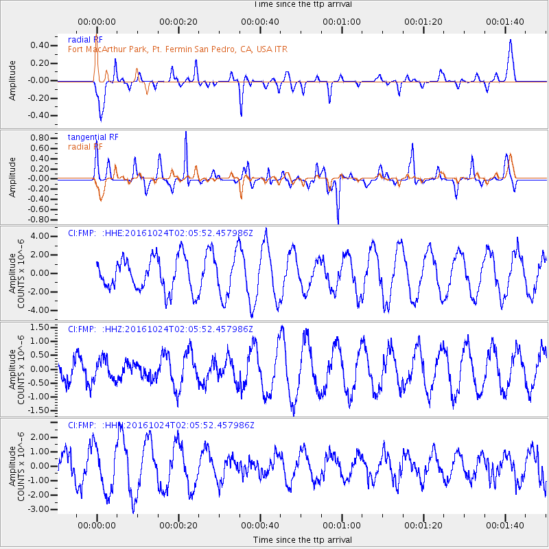
FMP Fort MacArthur Park, Pt. Fermin San Pedro, CA, USA - Earthquake Result Viewer
*The percent match for this event was below the threshold and hence no stack was calculated.
| Earthquake location: |
Southeast Of Easter Island |
| Earthquake latitude/longitude: |
-36.0/-102.7 |
| Earthquake time(UTC): |
2016/10/24 (298) 01:55:06 GMT |
| Earthquake Depth: |
10 km |
| Earthquake Magnitude: |
5.5 Mwb |
| Earthquake Catalog/Contributor: |
NEIC PDE/us |
|
| Network: |
CI Caltech Regional Seismic Network |
| Station: |
FMP Fort MacArthur Park, Pt. Fermin San Pedro, CA, USA |
| Lat/Lon: |
33.71 N/118.29 W |
| Elevation: |
89 m |
|
| Distance: |
70.9 deg |
| Az: |
346.27 deg |
| Baz: |
166.65 deg |
| Ray Param: |
$rayparam |
*The percent match for this event was below the threshold and hence was not used in the summary stack. |
|
| Radial Match: |
65.036285 % |
| Radial Bump: |
279 |
| Transverse Match: |
53.201904 % |
| Transverse Bump: |
239 |
| SOD ConfigId: |
11737051 |
| Insert Time: |
2019-04-25 21:39:06.240 +0000 |
| GWidth: |
2.5 |
| Max Bumps: |
400 |
| Tol: |
0.001 |
|
Signal To Noise
| Channel | StoN | STA | LTA |
| CI:FMP: :HHZ:20161024T02:05:52.457986Z | 0.6266586 | 3.7466097E-7 | 5.9787095E-7 |
| CI:FMP: :HHN:20161024T02:05:52.457986Z | 2.265422 | 1.6065145E-6 | 7.091458E-7 |
| CI:FMP: :HHE:20161024T02:05:52.457986Z | 1.3750392 | 2.4031483E-6 | 1.7476945E-6 |
| Arrivals |
| Ps | |
| PpPs | |
| PsPs/PpSs | |


