You are here: Home > Network List > AV - Alaska Volcano Observatory Stations List
> Station MAPS Pakushin Southeast, Makushin Volcano, Alaska > Earthquake Result Viewer
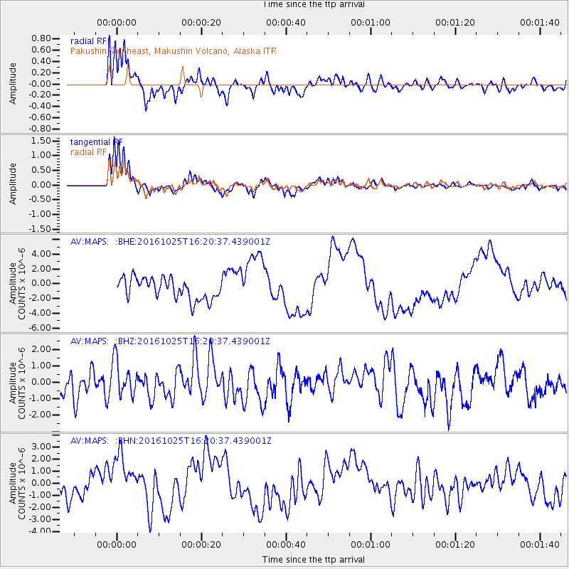
MAPS Pakushin Southeast, Makushin Volcano, Alaska - Earthquake Result Viewer
*The percent match for this event was below the threshold and hence no stack was calculated.
| Earthquake location: |
Tonga Islands |
| Earthquake latitude/longitude: |
-15.4/-174.8 |
| Earthquake time(UTC): |
2016/10/25 (299) 16:10:01 GMT |
| Earthquake Depth: |
0.0 km |
| Earthquake Magnitude: |
5.8 |
| Earthquake Catalog/Contributor: |
NEIC PDE/us |
|
| Network: |
AV Alaska Volcano Observatory |
| Station: |
MAPS Pakushin Southeast, Makushin Volcano, Alaska |
| Lat/Lon: |
53.81 N/166.94 W |
| Elevation: |
333 m |
|
| Distance: |
69.2 deg |
| Az: |
4.993 deg |
| Baz: |
188.137 deg |
| Ray Param: |
$rayparam |
*The percent match for this event was below the threshold and hence was not used in the summary stack. |
|
| Radial Match: |
62.26195 % |
| Radial Bump: |
400 |
| Transverse Match: |
65.70628 % |
| Transverse Bump: |
341 |
| SOD ConfigId: |
11737051 |
| Insert Time: |
2019-04-25 21:54:10.627 +0000 |
| GWidth: |
2.5 |
| Max Bumps: |
400 |
| Tol: |
0.001 |
|
Signal To Noise
| Channel | StoN | STA | LTA |
| AV:MAPS: :BHZ:20161025T16:20:37.439001Z | 1.1669816 | 1.1004488E-6 | 9.4298724E-7 |
| AV:MAPS: :BHN:20161025T16:20:37.439001Z | 2.5678294 | 2.005585E-6 | 7.810429E-7 |
| AV:MAPS: :BHE:20161025T16:20:37.439001Z | 2.4727967 | 3.7351817E-6 | 1.5105092E-6 |
| Arrivals |
| Ps | |
| PpPs | |
| PsPs/PpSs | |


