You are here: Home > Network List > TA - USArray Transportable Network (new EarthScope stations) Stations List
> Station R31K City Hall, Gustavus, AK, USA > Earthquake Result Viewer
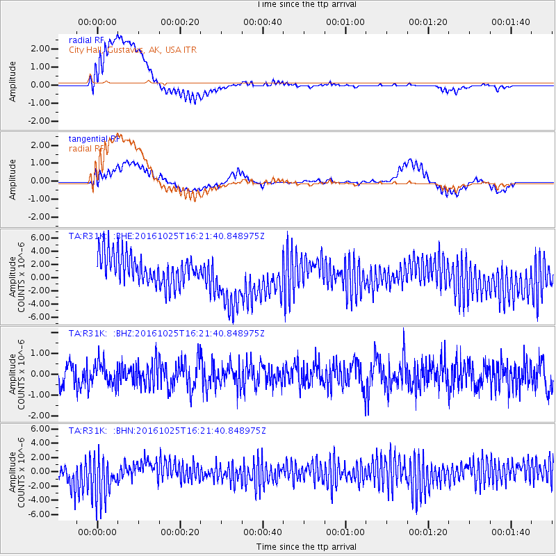
R31K City Hall, Gustavus, AK, USA - Earthquake Result Viewer
*The percent match for this event was below the threshold and hence no stack was calculated.
| Earthquake location: |
Tonga Islands |
| Earthquake latitude/longitude: |
-15.4/-174.8 |
| Earthquake time(UTC): |
2016/10/25 (299) 16:10:01 GMT |
| Earthquake Depth: |
0.0 km |
| Earthquake Magnitude: |
5.8 |
| Earthquake Catalog/Contributor: |
NEIC PDE/us |
|
| Network: |
TA USArray Transportable Network (new EarthScope stations) |
| Station: |
R31K City Hall, Gustavus, AK, USA |
| Lat/Lon: |
58.41 N/135.74 W |
| Elevation: |
15 m |
|
| Distance: |
80.2 deg |
| Az: |
19.679 deg |
| Baz: |
218.109 deg |
| Ray Param: |
$rayparam |
*The percent match for this event was below the threshold and hence was not used in the summary stack. |
|
| Radial Match: |
48.08997 % |
| Radial Bump: |
400 |
| Transverse Match: |
29.307035 % |
| Transverse Bump: |
400 |
| SOD ConfigId: |
11737051 |
| Insert Time: |
2019-04-25 22:00:09.466 +0000 |
| GWidth: |
2.5 |
| Max Bumps: |
400 |
| Tol: |
0.001 |
|
Signal To Noise
| Channel | StoN | STA | LTA |
| TA:R31K: :BHZ:20161025T16:21:40.848975Z | 0.8977953 | 5.276967E-7 | 5.877695E-7 |
| TA:R31K: :BHN:20161025T16:21:40.848975Z | 1.7587823 | 2.9199048E-6 | 1.6601855E-6 |
| TA:R31K: :BHE:20161025T16:21:40.848975Z | 2.3785748 | 4.913278E-6 | 2.0656396E-6 |
| Arrivals |
| Ps | |
| PpPs | |
| PsPs/PpSs | |


