You are here: Home > Network List > US - United States National Seismic Network Stations List
> Station WMOK Wichita Mountains, Oklahoma, USA > Earthquake Result Viewer
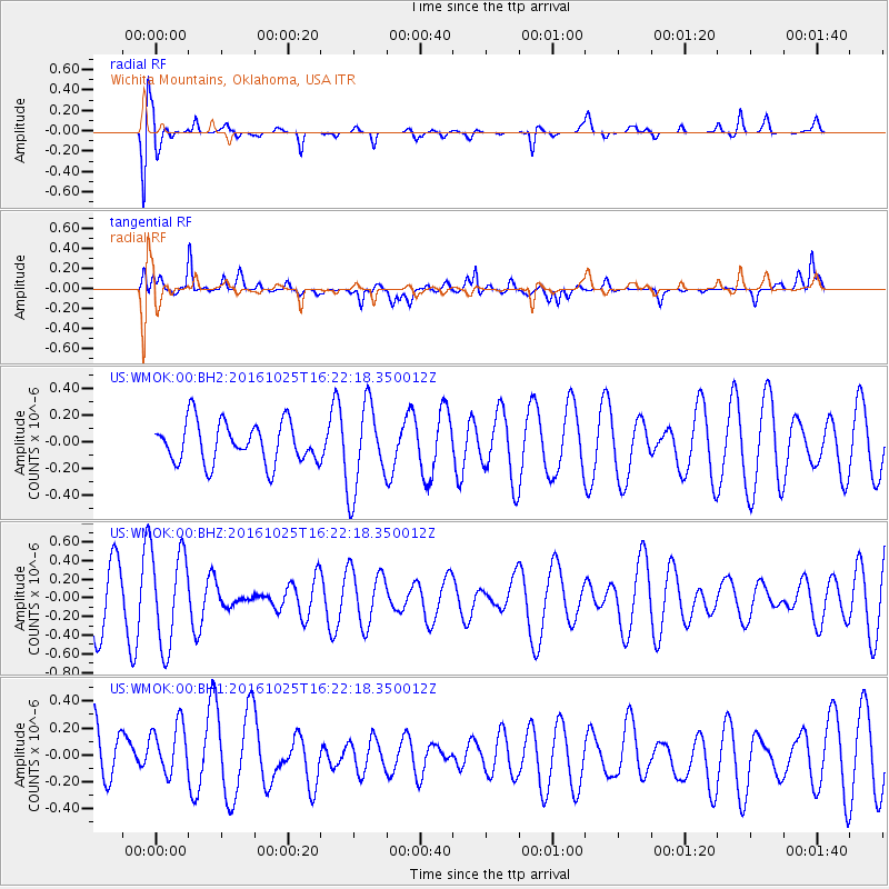
WMOK Wichita Mountains, Oklahoma, USA - Earthquake Result Viewer
*The percent match for this event was below the threshold and hence no stack was calculated.
| Earthquake location: |
Tonga Islands |
| Earthquake latitude/longitude: |
-15.4/-174.8 |
| Earthquake time(UTC): |
2016/10/25 (299) 16:10:01 GMT |
| Earthquake Depth: |
0.0 km |
| Earthquake Magnitude: |
5.8 |
| Earthquake Catalog/Contributor: |
NEIC PDE/us |
|
| Network: |
US United States National Seismic Network |
| Station: |
WMOK Wichita Mountains, Oklahoma, USA |
| Lat/Lon: |
34.74 N/98.78 W |
| Elevation: |
486 m |
|
| Distance: |
87.6 deg |
| Az: |
53.126 deg |
| Baz: |
249.549 deg |
| Ray Param: |
$rayparam |
*The percent match for this event was below the threshold and hence was not used in the summary stack. |
|
| Radial Match: |
60.785217 % |
| Radial Bump: |
400 |
| Transverse Match: |
60.691498 % |
| Transverse Bump: |
400 |
| SOD ConfigId: |
11737051 |
| Insert Time: |
2019-04-25 22:00:42.292 +0000 |
| GWidth: |
2.5 |
| Max Bumps: |
400 |
| Tol: |
0.001 |
|
Signal To Noise
| Channel | StoN | STA | LTA |
| US:WMOK:00:BHZ:20161025T16:22:18.350012Z | 1.6170554 | 5.0469873E-7 | 3.1210973E-7 |
| US:WMOK:00:BH1:20161025T16:22:18.350012Z | 0.853948 | 2.0867806E-7 | 2.4436858E-7 |
| US:WMOK:00:BH2:20161025T16:22:18.350012Z | 1.5879366 | 2.4715385E-7 | 1.5564466E-7 |
| Arrivals |
| Ps | |
| PpPs | |
| PsPs/PpSs | |


