You are here: Home > Network List > CI - Caltech Regional Seismic Network Stations List
> Station DAN Danby, California, USA > Earthquake Result Viewer
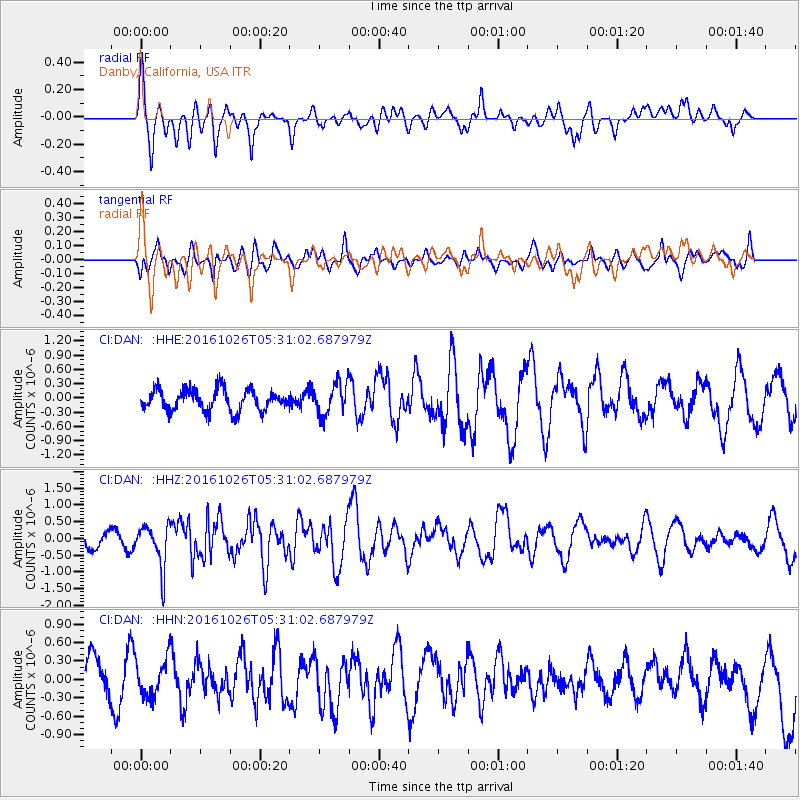
DAN Danby, California, USA - Earthquake Result Viewer
*The percent match for this event was below the threshold and hence no stack was calculated.
| Earthquake location: |
Tonga Islands |
| Earthquake latitude/longitude: |
-15.5/-174.9 |
| Earthquake time(UTC): |
2016/10/26 (300) 05:19:50 GMT |
| Earthquake Depth: |
10 km |
| Earthquake Magnitude: |
6.1 MWW, 6.1 MWC |
| Earthquake Catalog/Contributor: |
NEIC PDE/NEIC COMCAT |
|
| Network: |
CI Caltech Regional Seismic Network |
| Station: |
DAN Danby, California, USA |
| Lat/Lon: |
34.64 N/115.38 W |
| Elevation: |
398 m |
|
| Distance: |
75.4 deg |
| Az: |
47.244 deg |
| Baz: |
239.132 deg |
| Ray Param: |
$rayparam |
*The percent match for this event was below the threshold and hence was not used in the summary stack. |
|
| Radial Match: |
64.06564 % |
| Radial Bump: |
400 |
| Transverse Match: |
54.42545 % |
| Transverse Bump: |
400 |
| SOD ConfigId: |
11737051 |
| Insert Time: |
2019-04-25 22:05:25.892 +0000 |
| GWidth: |
2.5 |
| Max Bumps: |
400 |
| Tol: |
0.001 |
|
Signal To Noise
| Channel | StoN | STA | LTA |
| CI:DAN: :HHZ:20161026T05:31:02.687979Z | 3.3620162 | 6.3371454E-7 | 1.8849241E-7 |
| CI:DAN: :HHN:20161026T05:31:02.687979Z | 1.0491726 | 2.9785684E-7 | 2.838969E-7 |
| CI:DAN: :HHE:20161026T05:31:02.687979Z | 1.5157393 | 3.380728E-7 | 2.2304151E-7 |
| Arrivals |
| Ps | |
| PpPs | |
| PsPs/PpSs | |


