You are here: Home > Network List > UW - Pacific Northwest Regional Seismic Network Stations List
> Station LON Longmire CREST broad-band > Earthquake Result Viewer
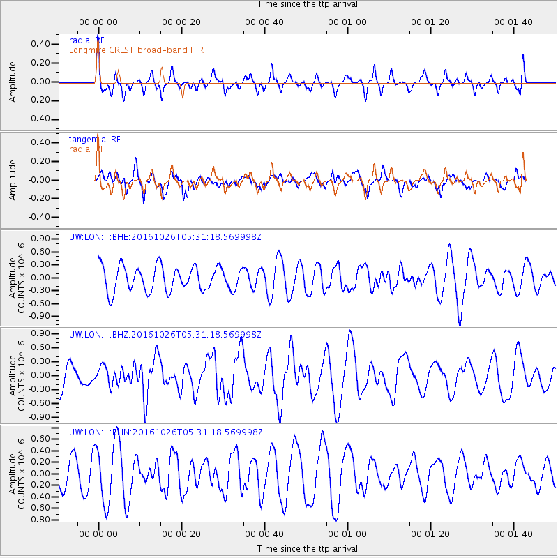
LON Longmire CREST broad-band - Earthquake Result Viewer
*The percent match for this event was below the threshold and hence no stack was calculated.
| Earthquake location: |
Tonga Islands |
| Earthquake latitude/longitude: |
-15.5/-174.9 |
| Earthquake time(UTC): |
2016/10/26 (300) 05:19:50 GMT |
| Earthquake Depth: |
10 km |
| Earthquake Magnitude: |
6.1 MWW, 6.1 MWC |
| Earthquake Catalog/Contributor: |
NEIC PDE/NEIC COMCAT |
|
| Network: |
UW Pacific Northwest Regional Seismic Network |
| Station: |
LON Longmire CREST broad-band |
| Lat/Lon: |
46.75 N/121.81 W |
| Elevation: |
853 m |
|
| Distance: |
78.2 deg |
| Az: |
34.162 deg |
| Baz: |
231.921 deg |
| Ray Param: |
$rayparam |
*The percent match for this event was below the threshold and hence was not used in the summary stack. |
|
| Radial Match: |
42.54743 % |
| Radial Bump: |
376 |
| Transverse Match: |
57.883007 % |
| Transverse Bump: |
400 |
| SOD ConfigId: |
11737051 |
| Insert Time: |
2019-04-25 22:10:08.109 +0000 |
| GWidth: |
2.5 |
| Max Bumps: |
400 |
| Tol: |
0.001 |
|
Signal To Noise
| Channel | StoN | STA | LTA |
| UW:LON: :BHZ:20161026T05:31:18.569998Z | 0.8255437 | 1.898126E-7 | 2.2992435E-7 |
| UW:LON: :BHN:20161026T05:31:18.569998Z | 2.1553757 | 5.4575463E-7 | 2.5320628E-7 |
| UW:LON: :BHE:20161026T05:31:18.569998Z | 0.80150294 | 2.385281E-7 | 2.9760102E-7 |
| Arrivals |
| Ps | |
| PpPs | |
| PsPs/PpSs | |


