You are here: Home > Network List > UW - Pacific Northwest Regional Seismic Network Stations List
> Station UMAT Pilot Rock, OR, USA > Earthquake Result Viewer
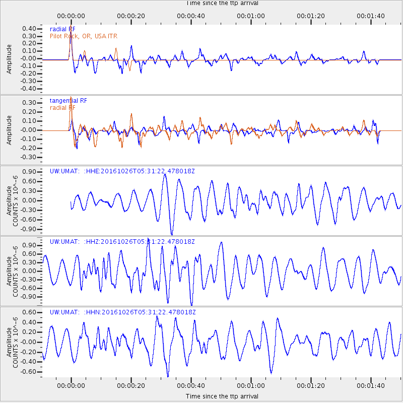
UMAT Pilot Rock, OR, USA - Earthquake Result Viewer
*The percent match for this event was below the threshold and hence no stack was calculated.
| Earthquake location: |
Tonga Islands |
| Earthquake latitude/longitude: |
-15.5/-174.9 |
| Earthquake time(UTC): |
2016/10/26 (300) 05:19:50 GMT |
| Earthquake Depth: |
10 km |
| Earthquake Magnitude: |
6.1 MWW, 6.1 MWC |
| Earthquake Catalog/Contributor: |
NEIC PDE/NEIC COMCAT |
|
| Network: |
UW Pacific Northwest Regional Seismic Network |
| Station: |
UMAT Pilot Rock, OR, USA |
| Lat/Lon: |
45.29 N/118.96 W |
| Elevation: |
1318 m |
|
| Distance: |
78.9 deg |
| Az: |
36.569 deg |
| Baz: |
234.444 deg |
| Ray Param: |
$rayparam |
*The percent match for this event was below the threshold and hence was not used in the summary stack. |
|
| Radial Match: |
74.007515 % |
| Radial Bump: |
396 |
| Transverse Match: |
42.75892 % |
| Transverse Bump: |
310 |
| SOD ConfigId: |
11737051 |
| Insert Time: |
2019-04-25 22:10:11.982 +0000 |
| GWidth: |
2.5 |
| Max Bumps: |
400 |
| Tol: |
0.001 |
|
Signal To Noise
| Channel | StoN | STA | LTA |
| UW:UMAT: :HHZ:20161026T05:31:22.478018Z | 1.2243694 | 3.7971589E-7 | 3.101318E-7 |
| UW:UMAT: :HHN:20161026T05:31:22.478018Z | 1.3804402 | 2.5623737E-7 | 1.8562004E-7 |
| UW:UMAT: :HHE:20161026T05:31:22.478018Z | 3.4628685 | 6.1851495E-7 | 1.7861348E-7 |
| Arrivals |
| Ps | |
| PpPs | |
| PsPs/PpSs | |


