You are here: Home > Network List > TA - USArray Transportable Network (new EarthScope stations) Stations List
> Station J26L Joseph Creek, AK, USA > Earthquake Result Viewer
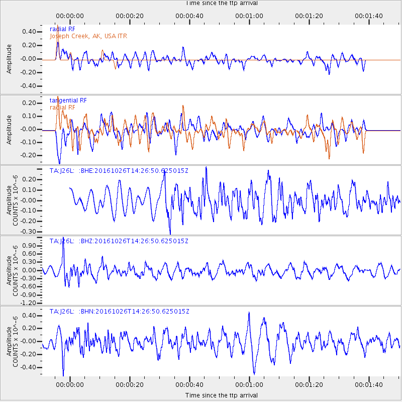
J26L Joseph Creek, AK, USA - Earthquake Result Viewer
*The percent match for this event was below the threshold and hence no stack was calculated.
| Earthquake location: |
Turkmenistan |
| Earthquake latitude/longitude: |
39.5/54.5 |
| Earthquake time(UTC): |
2016/10/26 (300) 14:15:40 GMT |
| Earthquake Depth: |
0.0 km |
| Earthquake Magnitude: |
5.4 |
| Earthquake Catalog/Contributor: |
NEIC PDE/us |
|
| Network: |
TA USArray Transportable Network (new EarthScope stations) |
| Station: |
J26L Joseph Creek, AK, USA |
| Lat/Lon: |
64.50 N/143.56 W |
| Elevation: |
1144 m |
|
| Distance: |
75.4 deg |
| Az: |
7.977 deg |
| Baz: |
345.634 deg |
| Ray Param: |
$rayparam |
*The percent match for this event was below the threshold and hence was not used in the summary stack. |
|
| Radial Match: |
49.293976 % |
| Radial Bump: |
400 |
| Transverse Match: |
65.07142 % |
| Transverse Bump: |
400 |
| SOD ConfigId: |
11737051 |
| Insert Time: |
2019-04-25 22:17:53.790 +0000 |
| GWidth: |
2.5 |
| Max Bumps: |
400 |
| Tol: |
0.001 |
|
Signal To Noise
| Channel | StoN | STA | LTA |
| TA:J26L: :BHZ:20161026T14:26:50.625015Z | 1.9963895 | 2.4473337E-7 | 1.2258798E-7 |
| TA:J26L: :BHN:20161026T14:26:50.625015Z | 1.0298343 | 1.234953E-7 | 1.1991763E-7 |
| TA:J26L: :BHE:20161026T14:26:50.625015Z | 1.3898339 | 1.3357588E-7 | 9.610925E-8 |
| Arrivals |
| Ps | |
| PpPs | |
| PsPs/PpSs | |


