You are here: Home > Network List > GS - US Geological Survey Networks Stations List
> Station KAN11 Stewart Ranch, Harper County, KS, USA > Earthquake Result Viewer
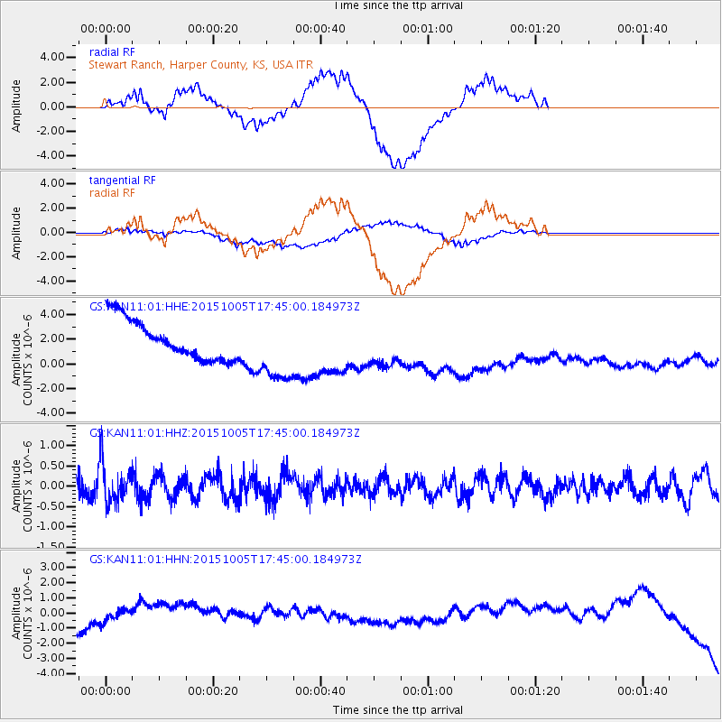
KAN11 Stewart Ranch, Harper County, KS, USA - Earthquake Result Viewer
*The percent match for this event was below the threshold and hence no stack was calculated.
| Earthquake location: |
Andreanof Islands, Aleutian Is. |
| Earthquake latitude/longitude: |
51.9/-179.3 |
| Earthquake time(UTC): |
2015/10/05 (278) 17:35:55 GMT |
| Earthquake Depth: |
89 km |
| Earthquake Magnitude: |
5.7 MB |
| Earthquake Catalog/Contributor: |
NEIC PDE/NEIC ALERT |
|
| Network: |
GS US Geological Survey Networks |
| Station: |
KAN11 Stewart Ranch, Harper County, KS, USA |
| Lat/Lon: |
37.21 N/97.91 W |
| Elevation: |
410 m |
|
| Distance: |
56.9 deg |
| Az: |
70.523 deg |
| Baz: |
312.981 deg |
| Ray Param: |
$rayparam |
*The percent match for this event was below the threshold and hence was not used in the summary stack. |
|
| Radial Match: |
39.39384 % |
| Radial Bump: |
400 |
| Transverse Match: |
34.696625 % |
| Transverse Bump: |
400 |
| SOD ConfigId: |
1156111 |
| Insert Time: |
2015-10-19 18:34:48.049 +0000 |
| GWidth: |
2.5 |
| Max Bumps: |
400 |
| Tol: |
0.001 |
|
Signal To Noise
| Channel | StoN | STA | LTA |
| GS:KAN11:01:HHZ:20151005T17:45:00.184973Z | 2.1594331 | 5.027489E-7 | 2.3281522E-7 |
| GS:KAN11:01:HHN:20151005T17:45:00.184973Z | 1.3872035 | 6.1926926E-7 | 4.4641558E-7 |
| GS:KAN11:01:HHE:20151005T17:45:00.184973Z | 1.7318774 | 2.792265E-6 | 1.6122763E-6 |
| Arrivals |
| Ps | |
| PpPs | |
| PsPs/PpSs | |


