You are here: Home > Network List > IW - Intermountain West Stations List
> Station MOOW Moose Ponds, Wyoming, USA > Earthquake Result Viewer
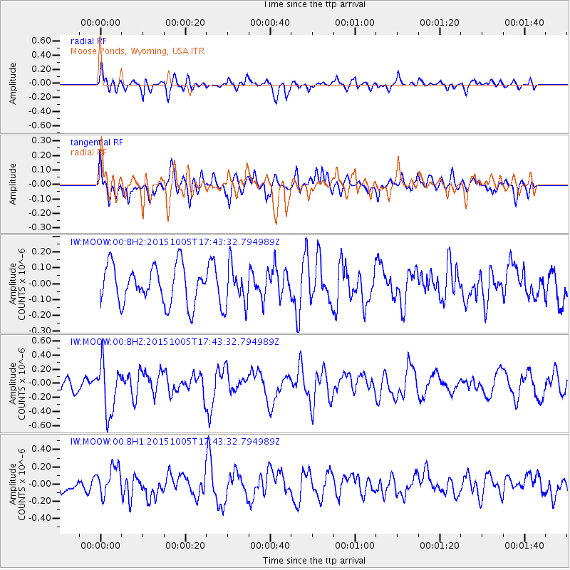
MOOW Moose Ponds, Wyoming, USA - Earthquake Result Viewer
*The percent match for this event was below the threshold and hence no stack was calculated.
| Earthquake location: |
Andreanof Islands, Aleutian Is. |
| Earthquake latitude/longitude: |
51.9/-179.3 |
| Earthquake time(UTC): |
2015/10/05 (278) 17:35:55 GMT |
| Earthquake Depth: |
89 km |
| Earthquake Magnitude: |
5.7 MB |
| Earthquake Catalog/Contributor: |
NEIC PDE/NEIC ALERT |
|
| Network: |
IW Intermountain West |
| Station: |
MOOW Moose Ponds, Wyoming, USA |
| Lat/Lon: |
43.75 N/110.74 W |
| Elevation: |
2128 m |
|
| Distance: |
45.2 deg |
| Az: |
72.017 deg |
| Baz: |
305.594 deg |
| Ray Param: |
$rayparam |
*The percent match for this event was below the threshold and hence was not used in the summary stack. |
|
| Radial Match: |
58.554134 % |
| Radial Bump: |
400 |
| Transverse Match: |
58.76236 % |
| Transverse Bump: |
400 |
| SOD ConfigId: |
1156111 |
| Insert Time: |
2015-10-19 18:37:47.862 +0000 |
| GWidth: |
2.5 |
| Max Bumps: |
400 |
| Tol: |
0.001 |
|
Signal To Noise
| Channel | StoN | STA | LTA |
| IW:MOOW:00:BHZ:20151005T17:43:32.794989Z | 2.1686254 | 3.571494E-7 | 1.6468931E-7 |
| IW:MOOW:00:BH1:20151005T17:43:32.794989Z | 1.7586023 | 1.7127068E-7 | 9.7390235E-8 |
| IW:MOOW:00:BH2:20151005T17:43:32.794989Z | 1.1128943 | 1.3109535E-7 | 1.1779676E-7 |
| Arrivals |
| Ps | |
| PpPs | |
| PsPs/PpSs | |


