You are here: Home > Network List > CN - Canadian National Seismograph Network Stations List
> Station INK INUVIK, NT > Earthquake Result Viewer
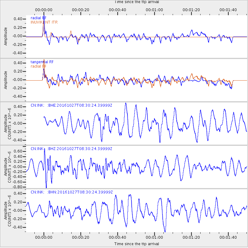
INK INUVIK, NT - Earthquake Result Viewer
*The percent match for this event was below the threshold and hence no stack was calculated.
| Earthquake location: |
Northern Molucca Sea |
| Earthquake latitude/longitude: |
1.3/125.8 |
| Earthquake time(UTC): |
2016/10/27 (301) 08:17:49 GMT |
| Earthquake Depth: |
56 km |
| Earthquake Magnitude: |
5.9 MB, 5.8 MWB |
| Earthquake Catalog/Contributor: |
NEIC PDE/NEIC COMCAT |
|
| Network: |
CN Canadian National Seismograph Network |
| Station: |
INK INUVIK, NT |
| Lat/Lon: |
68.31 N/133.53 W |
| Elevation: |
44 m |
|
| Distance: |
92.7 deg |
| Az: |
21.454 deg |
| Baz: |
280.415 deg |
| Ray Param: |
$rayparam |
*The percent match for this event was below the threshold and hence was not used in the summary stack. |
|
| Radial Match: |
54.97894 % |
| Radial Bump: |
400 |
| Transverse Match: |
48.301098 % |
| Transverse Bump: |
400 |
| SOD ConfigId: |
11737051 |
| Insert Time: |
2019-04-25 22:46:24.673 +0000 |
| GWidth: |
2.5 |
| Max Bumps: |
400 |
| Tol: |
0.001 |
|
Signal To Noise
| Channel | StoN | STA | LTA |
| CN:INK: :BHZ:20161027T08:30:24.39999Z | 2.5436132 | 3.8993272E-7 | 1.5329876E-7 |
| CN:INK: :BHN:20161027T08:30:24.39999Z | 0.7341215 | 1.1094548E-7 | 1.5112686E-7 |
| CN:INK: :BHE:20161027T08:30:24.39999Z | 1.7158316 | 1.9800999E-7 | 1.15401754E-7 |
| Arrivals |
| Ps | |
| PpPs | |
| PsPs/PpSs | |


