You are here: Home > Network List > TA - USArray Transportable Network (new EarthScope stations) Stations List
> Station M22K Willow, AK, USA > Earthquake Result Viewer
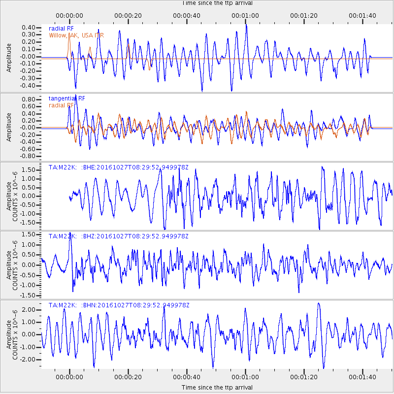
M22K Willow, AK, USA - Earthquake Result Viewer
*The percent match for this event was below the threshold and hence no stack was calculated.
| Earthquake location: |
Northern Molucca Sea |
| Earthquake latitude/longitude: |
1.3/125.8 |
| Earthquake time(UTC): |
2016/10/27 (301) 08:17:49 GMT |
| Earthquake Depth: |
56 km |
| Earthquake Magnitude: |
5.9 MB, 5.8 MWB |
| Earthquake Catalog/Contributor: |
NEIC PDE/NEIC COMCAT |
|
| Network: |
TA USArray Transportable Network (new EarthScope stations) |
| Station: |
M22K Willow, AK, USA |
| Lat/Lon: |
61.75 N/150.12 W |
| Elevation: |
57 m |
|
| Distance: |
86.0 deg |
| Az: |
28.317 deg |
| Baz: |
265.421 deg |
| Ray Param: |
$rayparam |
*The percent match for this event was below the threshold and hence was not used in the summary stack. |
|
| Radial Match: |
38.243343 % |
| Radial Bump: |
400 |
| Transverse Match: |
60.588818 % |
| Transverse Bump: |
400 |
| SOD ConfigId: |
11737051 |
| Insert Time: |
2019-04-25 22:48:22.703 +0000 |
| GWidth: |
2.5 |
| Max Bumps: |
400 |
| Tol: |
0.001 |
|
Signal To Noise
| Channel | StoN | STA | LTA |
| TA:M22K: :BHZ:20161027T08:29:52.949978Z | 2.2834613 | 7.1465695E-7 | 3.129709E-7 |
| TA:M22K: :BHN:20161027T08:29:52.949978Z | 1.6869636 | 1.1044233E-6 | 6.5468123E-7 |
| TA:M22K: :BHE:20161027T08:29:52.949978Z | 1.7262937 | 1.0013266E-6 | 5.8004423E-7 |
| Arrivals |
| Ps | |
| PpPs | |
| PsPs/PpSs | |


