
FARB Farallon Islands, CA - Earthquake Result Viewer
| ||||||||||||||||||
| ||||||||||||||||||
| ||||||||||||||||||
|
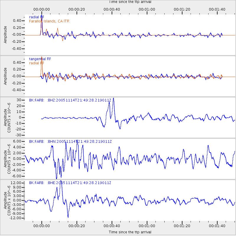
Signal To Noise
| Channel | StoN | STA | LTA |
| BK:FARB: :BHN:20051114T21:49:28.219011Z | 1.3816568 | 7.644992E-7 | 5.533206E-7 |
| BK:FARB: :BHE:20051114T21:49:28.219011Z | 2.9853566 | 1.7510397E-6 | 5.865429E-7 |
| BK:FARB: :BHZ:20051114T21:49:28.219011Z | 6.583855 | 3.9708016E-6 | 6.031119E-7 |
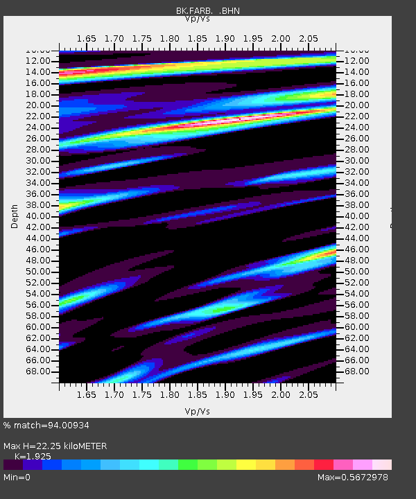
| Arrivals | |
| Ps | 3.4 SECOND |
| PpPs | 10 SECOND |
| PsPs/PpSs | 14 SECOND |

