You are here: Home > Network List > TA - USArray Transportable Network (new EarthScope stations) Stations List
> Station WHTX Lake Whitney, Meridian, TX, USA > Earthquake Result Viewer
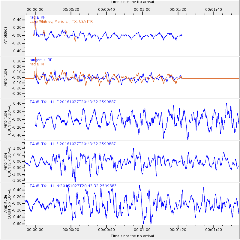
WHTX Lake Whitney, Meridian, TX, USA - Earthquake Result Viewer
*The percent match for this event was below the threshold and hence no stack was calculated.
| Earthquake location: |
Off Coast Of Central Chile |
| Earthquake latitude/longitude: |
-33.8/-72.5 |
| Earthquake time(UTC): |
2016/10/27 (301) 20:32:55 GMT |
| Earthquake Depth: |
15 km |
| Earthquake Magnitude: |
5.9 MWB |
| Earthquake Catalog/Contributor: |
NEIC PDE/NEIC COMCAT |
|
| Network: |
TA USArray Transportable Network (new EarthScope stations) |
| Station: |
WHTX Lake Whitney, Meridian, TX, USA |
| Lat/Lon: |
31.99 N/97.46 W |
| Elevation: |
190 m |
|
| Distance: |
69.5 deg |
| Az: |
337.525 deg |
| Baz: |
157.989 deg |
| Ray Param: |
$rayparam |
*The percent match for this event was below the threshold and hence was not used in the summary stack. |
|
| Radial Match: |
76.529655 % |
| Radial Bump: |
400 |
| Transverse Match: |
58.36884 % |
| Transverse Bump: |
400 |
| SOD ConfigId: |
11737051 |
| Insert Time: |
2019-04-25 23:04:38.050 +0000 |
| GWidth: |
2.5 |
| Max Bumps: |
400 |
| Tol: |
0.001 |
|
Signal To Noise
| Channel | StoN | STA | LTA |
| TA:WHTX: :HHZ:20161027T20:43:32.259988Z | 2.2699983 | 2.5994495E-7 | 1.14513284E-7 |
| TA:WHTX: :HHN:20161027T20:43:32.259988Z | 0.6949672 | 7.095542E-8 | 1.0209895E-7 |
| TA:WHTX: :HHE:20161027T20:43:32.259988Z | 1.5378994 | 1.5848971E-7 | 1.03055974E-7 |
| Arrivals |
| Ps | |
| PpPs | |
| PsPs/PpSs | |


