FARB Farallon Islands, CA - Earthquake Result Viewer
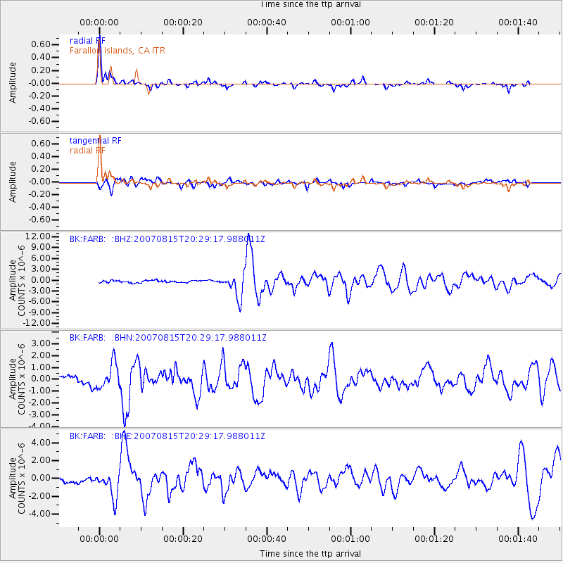
Earthquake location: Andreanof Islands, Aleutian Is.
Earthquake latitude/longitude: 50.3/-177.5
Earthquake time(UTC): 2007/08/15 (227) 20:22:11 GMT
Earthquake Depth: 9.0 km
Earthquake Magnitude: 6.3 MB, 6.2 MS, 6.4 MW, 5.9 ML
Earthquake Catalog/Contributor: WHDF/NEIC
Network: BK Berkeley Digital Seismograph Network
Station: FARB Farallon Islands, CA
Lat/Lon: 37.70 N/123.00 W
Elevation: -18.5 m
Distance: 40.3 deg
Az: 86.706 deg
Baz: 306.219 deg
Ray Param: 0.07446146
Estimated Moho Depth: 25.25 km
Estimated Crust Vp/Vs: 1.60
Assumed Crust Vp: 6.183 km/s
Estimated Crust Vs: 3.858 km/s
Estimated Crust Poisson's Ratio: 0.18
Radial Match: 86.67472 %
Radial Bump: 297
Transverse Match: 77.897446 %
Transverse Bump: 400
SOD ConfigId: 2564
Insert Time: 2010-03-05 19:16:31.414 +0000
GWidth: 2.5
Max Bumps: 400
Tol: 0.001

Signal To Noise

ChannelStoNSTALTA
BK:FARB: :BHN:20070815T20:29:17.988011Z5.1237611.0815195E-62.1107921E-7
BK:FARB: :BHE:20070815T20:29:17.988011Z6.50460961.5272419E-62.3479377E-7
BK:FARB: :BHZ:20070815T20:29:17.988011Z11.3896283.376972E-62.9649536E-7
Arrivals
Ps2.6 SECOND
PpPs9.9 SECOND
PsPs/PpSs13 SECOND