You are here: Home > Network List > TA - USArray Transportable Network (new EarthScope stations) Stations List
> Station A36M Sachs Harbour, NT, CAN > Earthquake Result Viewer
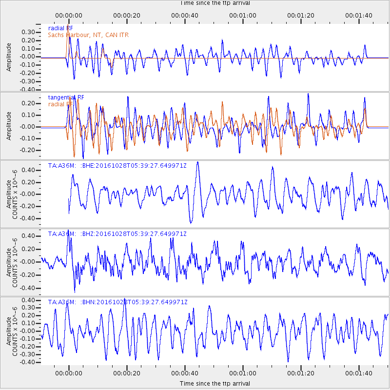
A36M Sachs Harbour, NT, CAN - Earthquake Result Viewer
*The percent match for this event was below the threshold and hence no stack was calculated.
| Earthquake location: |
New Ireland Region, P.N.G. |
| Earthquake latitude/longitude: |
-4.7/153.2 |
| Earthquake time(UTC): |
2016/10/28 (302) 05:26:57 GMT |
| Earthquake Depth: |
61 km |
| Earthquake Magnitude: |
5.7 MB |
| Earthquake Catalog/Contributor: |
NEIC PDE/NEIC COMCAT |
|
| Network: |
TA USArray Transportable Network (new EarthScope stations) |
| Station: |
A36M Sachs Harbour, NT, CAN |
| Lat/Lon: |
71.99 N/125.25 W |
| Elevation: |
32 m |
|
| Distance: |
91.9 deg |
| Az: |
17.935 deg |
| Baz: |
260.568 deg |
| Ray Param: |
$rayparam |
*The percent match for this event was below the threshold and hence was not used in the summary stack. |
|
| Radial Match: |
29.203108 % |
| Radial Bump: |
400 |
| Transverse Match: |
48.256496 % |
| Transverse Bump: |
400 |
| SOD ConfigId: |
11737051 |
| Insert Time: |
2019-04-25 23:11:20.659 +0000 |
| GWidth: |
2.5 |
| Max Bumps: |
400 |
| Tol: |
0.001 |
|
Signal To Noise
| Channel | StoN | STA | LTA |
| TA:A36M: :BHZ:20161028T05:39:27.649971Z | 2.9370604 | 2.4257747E-7 | 8.2591924E-8 |
| TA:A36M: :BHN:20161028T05:39:27.649971Z | 1.3674653 | 1.6871881E-7 | 1.233807E-7 |
| TA:A36M: :BHE:20161028T05:39:27.649971Z | 0.76506466 | 1.071268E-7 | 1.4002319E-7 |
| Arrivals |
| Ps | |
| PpPs | |
| PsPs/PpSs | |


