
FARB Farallon Islands, CA - Earthquake Result Viewer
| ||||||||||||||||||
| ||||||||||||||||||
| ||||||||||||||||||
|
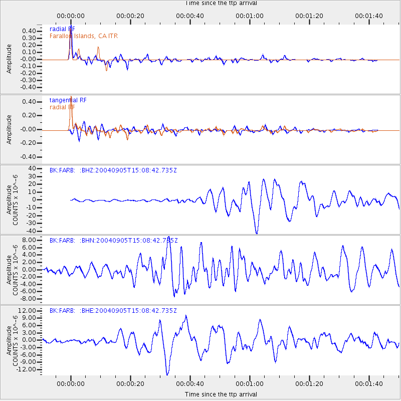
Signal To Noise
| Channel | StoN | STA | LTA |
| BK:FARB: :BHN:20040905T15:08:42.735Z | 1.6912673 | 9.959022E-7 | 5.888496E-7 |
| BK:FARB: :BHE:20040905T15:08:42.735Z | 0.8866285 | 4.6317976E-7 | 5.224057E-7 |
| BK:FARB: :BHZ:20040905T15:08:42.735Z | 1.206786 | 9.924295E-7 | 8.2237403E-7 |
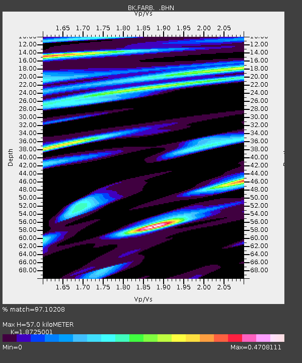
| Arrivals | |
| Ps | 8.3 SECOND |
| PpPs | 26 SECOND |
| PsPs/PpSs | 34 SECOND |

