You are here: Home > Network List > TA - USArray Transportable Network (new EarthScope stations) Stations List
> Station G22K Bettles, AK, USA > Earthquake Result Viewer
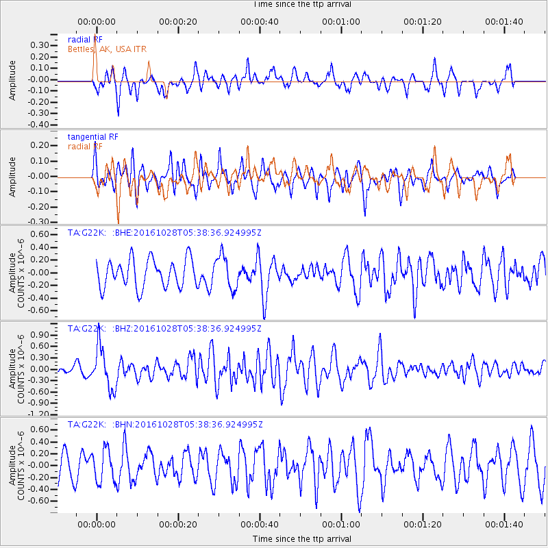
G22K Bettles, AK, USA - Earthquake Result Viewer
*The percent match for this event was below the threshold and hence no stack was calculated.
| Earthquake location: |
New Ireland Region, P.N.G. |
| Earthquake latitude/longitude: |
-4.7/153.2 |
| Earthquake time(UTC): |
2016/10/28 (302) 05:26:57 GMT |
| Earthquake Depth: |
61 km |
| Earthquake Magnitude: |
5.7 MB |
| Earthquake Catalog/Contributor: |
NEIC PDE/NEIC COMCAT |
|
| Network: |
TA USArray Transportable Network (new EarthScope stations) |
| Station: |
G22K Bettles, AK, USA |
| Lat/Lon: |
66.92 N/151.51 W |
| Elevation: |
205 m |
|
| Distance: |
81.5 deg |
| Az: |
19.141 deg |
| Baz: |
235.993 deg |
| Ray Param: |
$rayparam |
*The percent match for this event was below the threshold and hence was not used in the summary stack. |
|
| Radial Match: |
42.866005 % |
| Radial Bump: |
336 |
| Transverse Match: |
49.833904 % |
| Transverse Bump: |
400 |
| SOD ConfigId: |
11737051 |
| Insert Time: |
2019-04-25 23:11:34.891 +0000 |
| GWidth: |
2.5 |
| Max Bumps: |
400 |
| Tol: |
0.001 |
|
Signal To Noise
| Channel | StoN | STA | LTA |
| TA:G22K: :BHZ:20161028T05:38:36.924995Z | 2.9438493 | 5.6864167E-7 | 1.9316262E-7 |
| TA:G22K: :BHN:20161028T05:38:36.924995Z | 0.991941 | 2.7169352E-7 | 2.739009E-7 |
| TA:G22K: :BHE:20161028T05:38:36.924995Z | 1.2072308 | 2.6571547E-7 | 2.201033E-7 |
| Arrivals |
| Ps | |
| PpPs | |
| PsPs/PpSs | |


