You are here: Home > Network List > TA - USArray Transportable Network (new EarthScope stations) Stations List
> Station J26L Joseph Creek, AK, USA > Earthquake Result Viewer
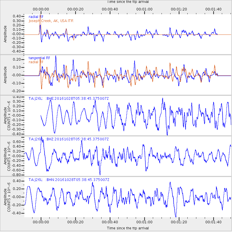
J26L Joseph Creek, AK, USA - Earthquake Result Viewer
*The percent match for this event was below the threshold and hence no stack was calculated.
| Earthquake location: |
New Ireland Region, P.N.G. |
| Earthquake latitude/longitude: |
-4.7/153.2 |
| Earthquake time(UTC): |
2016/10/28 (302) 05:26:57 GMT |
| Earthquake Depth: |
61 km |
| Earthquake Magnitude: |
5.7 MB |
| Earthquake Catalog/Contributor: |
NEIC PDE/NEIC COMCAT |
|
| Network: |
TA USArray Transportable Network (new EarthScope stations) |
| Station: |
J26L Joseph Creek, AK, USA |
| Lat/Lon: |
64.50 N/143.56 W |
| Elevation: |
1144 m |
|
| Distance: |
83.1 deg |
| Az: |
22.922 deg |
| Baz: |
243.737 deg |
| Ray Param: |
$rayparam |
*The percent match for this event was below the threshold and hence was not used in the summary stack. |
|
| Radial Match: |
57.480568 % |
| Radial Bump: |
400 |
| Transverse Match: |
60.727352 % |
| Transverse Bump: |
400 |
| SOD ConfigId: |
11737051 |
| Insert Time: |
2019-04-25 23:11:43.687 +0000 |
| GWidth: |
2.5 |
| Max Bumps: |
400 |
| Tol: |
0.001 |
|
Signal To Noise
| Channel | StoN | STA | LTA |
| TA:J26L: :BHZ:20161028T05:38:45.375007Z | 2.5433576 | 5.0465667E-7 | 1.9842143E-7 |
| TA:J26L: :BHN:20161028T05:38:45.375007Z | 0.79319113 | 1.09787585E-7 | 1.3841252E-7 |
| TA:J26L: :BHE:20161028T05:38:45.375007Z | 1.1370715 | 1.9480505E-7 | 1.7132172E-7 |
| Arrivals |
| Ps | |
| PpPs | |
| PsPs/PpSs | |


