
FARB Farallon Islands, CA - Earthquake Result Viewer
| ||||||||||||||||||
| ||||||||||||||||||
| ||||||||||||||||||
|
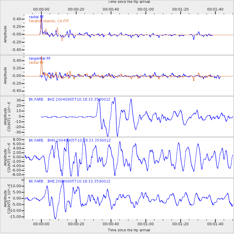
Signal To Noise
| Channel | StoN | STA | LTA |
| BK:FARB: :BHN:20040905T10:18:33.359001Z | 4.6591024 | 3.1347963E-6 | 6.728327E-7 |
| BK:FARB: :BHE:20040905T10:18:33.359001Z | 8.298434 | 4.938421E-6 | 5.951028E-7 |
| BK:FARB: :BHZ:20040905T10:18:33.359001Z | 23.5784 | 1.5948885E-5 | 6.764193E-7 |
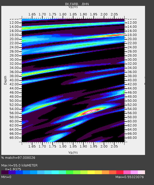
| Arrivals | |
| Ps | 8.6 SECOND |
| PpPs | 25 SECOND |
| PsPs/PpSs | 34 SECOND |

