You are here: Home > Network List > CI - Caltech Regional Seismic Network Stations List
> Station BAR Barrett, Tecate, CA, USA > Earthquake Result Viewer
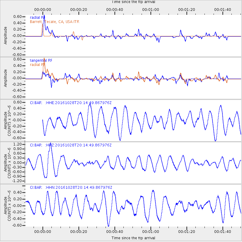
BAR Barrett, Tecate, CA, USA - Earthquake Result Viewer
*The percent match for this event was below the threshold and hence no stack was calculated.
| Earthquake location: |
Tyrrhenian Sea |
| Earthquake latitude/longitude: |
39.3/13.5 |
| Earthquake time(UTC): |
2016/10/28 (302) 20:02:48 GMT |
| Earthquake Depth: |
448 km |
| Earthquake Magnitude: |
5.8 MWW, 5.8 MWB |
| Earthquake Catalog/Contributor: |
NEIC PDE/NEIC COMCAT |
|
| Network: |
CI Caltech Regional Seismic Network |
| Station: |
BAR Barrett, Tecate, CA, USA |
| Lat/Lon: |
32.68 N/116.67 W |
| Elevation: |
521 m |
|
| Distance: |
94.8 deg |
| Az: |
319.736 deg |
| Baz: |
36.479 deg |
| Ray Param: |
$rayparam |
*The percent match for this event was below the threshold and hence was not used in the summary stack. |
|
| Radial Match: |
73.48218 % |
| Radial Bump: |
400 |
| Transverse Match: |
50.64508 % |
| Transverse Bump: |
400 |
| SOD ConfigId: |
11737051 |
| Insert Time: |
2019-04-25 23:15:51.136 +0000 |
| GWidth: |
2.5 |
| Max Bumps: |
400 |
| Tol: |
0.001 |
|
Signal To Noise
| Channel | StoN | STA | LTA |
| CI:BAR: :HHZ:20161028T20:14:49.867976Z | 3.4881725 | 7.9282404E-7 | 2.2728922E-7 |
| CI:BAR: :HHN:20161028T20:14:49.867976Z | 1.6358353 | 2.3364207E-7 | 1.4282739E-7 |
| CI:BAR: :HHE:20161028T20:14:49.867976Z | 1.9778699 | 3.5276773E-7 | 1.783574E-7 |
| Arrivals |
| Ps | |
| PpPs | |
| PsPs/PpSs | |


