You are here: Home > Network List > CI - Caltech Regional Seismic Network Stations List
> Station MPP McPhearson Peak > Earthquake Result Viewer
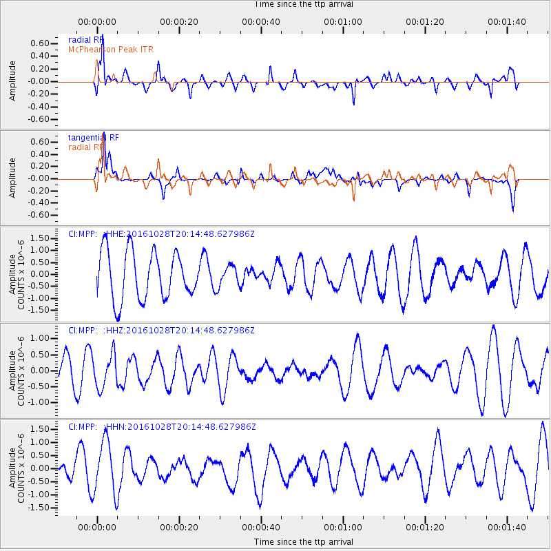
MPP McPhearson Peak - Earthquake Result Viewer
*The percent match for this event was below the threshold and hence no stack was calculated.
| Earthquake location: |
Tyrrhenian Sea |
| Earthquake latitude/longitude: |
39.3/13.5 |
| Earthquake time(UTC): |
2016/10/28 (302) 20:02:48 GMT |
| Earthquake Depth: |
448 km |
| Earthquake Magnitude: |
5.8 MWW, 5.8 MWB |
| Earthquake Catalog/Contributor: |
NEIC PDE/NEIC COMCAT |
|
| Network: |
CI Caltech Regional Seismic Network |
| Station: |
MPP McPhearson Peak |
| Lat/Lon: |
34.89 N/119.81 W |
| Elevation: |
1739 m |
|
| Distance: |
94.5 deg |
| Az: |
323.156 deg |
| Baz: |
34.463 deg |
| Ray Param: |
$rayparam |
*The percent match for this event was below the threshold and hence was not used in the summary stack. |
|
| Radial Match: |
62.833645 % |
| Radial Bump: |
400 |
| Transverse Match: |
55.019897 % |
| Transverse Bump: |
400 |
| SOD ConfigId: |
11737051 |
| Insert Time: |
2019-04-25 23:16:05.894 +0000 |
| GWidth: |
2.5 |
| Max Bumps: |
400 |
| Tol: |
0.001 |
|
Signal To Noise
| Channel | StoN | STA | LTA |
| CI:MPP: :HHZ:20161028T20:14:48.627986Z | 0.629023 | 5.157543E-7 | 8.199292E-7 |
| CI:MPP: :HHN:20161028T20:14:48.627986Z | 2.1463914 | 1.0783416E-6 | 5.023974E-7 |
| CI:MPP: :HHE:20161028T20:14:48.627986Z | 0.43420666 | 4.3017067E-7 | 9.907048E-7 |
| Arrivals |
| Ps | |
| PpPs | |
| PsPs/PpSs | |


