You are here: Home > Network List > LD - Lamont-Doherty Cooperative Seismographic Network Stations List
> Station GEDE Greenville, DE, USA > Earthquake Result Viewer
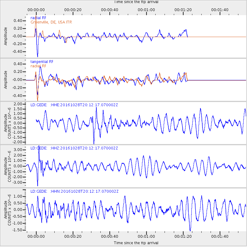
GEDE Greenville, DE, USA - Earthquake Result Viewer
*The percent match for this event was below the threshold and hence no stack was calculated.
| Earthquake location: |
Tyrrhenian Sea |
| Earthquake latitude/longitude: |
39.3/13.5 |
| Earthquake time(UTC): |
2016/10/28 (302) 20:02:48 GMT |
| Earthquake Depth: |
448 km |
| Earthquake Magnitude: |
5.8 MWW, 5.8 MWB |
| Earthquake Catalog/Contributor: |
NEIC PDE/NEIC COMCAT |
|
| Network: |
LD Lamont-Doherty Cooperative Seismographic Network |
| Station: |
GEDE Greenville, DE, USA |
| Lat/Lon: |
39.81 N/75.64 W |
| Elevation: |
105 m |
|
| Distance: |
65.7 deg |
| Az: |
302.343 deg |
| Baz: |
58.31 deg |
| Ray Param: |
$rayparam |
*The percent match for this event was below the threshold and hence was not used in the summary stack. |
|
| Radial Match: |
76.403725 % |
| Radial Bump: |
400 |
| Transverse Match: |
69.62109 % |
| Transverse Bump: |
400 |
| SOD ConfigId: |
11737051 |
| Insert Time: |
2019-04-25 23:18:21.323 +0000 |
| GWidth: |
2.5 |
| Max Bumps: |
400 |
| Tol: |
0.001 |
|
Signal To Noise
| Channel | StoN | STA | LTA |
| LD:GEDE: :HHZ:20161028T20:12:17.070002Z | 2.4200244 | 1.4369431E-6 | 5.937722E-7 |
| LD:GEDE: :HHN:20161028T20:12:17.070002Z | 1.5689315 | 5.534209E-7 | 3.5273746E-7 |
| LD:GEDE: :HHE:20161028T20:12:17.070002Z | 1.7156341 | 8.4824296E-7 | 4.944195E-7 |
| Arrivals |
| Ps | |
| PpPs | |
| PsPs/PpSs | |


