You are here: Home > Network List > TA - USArray Transportable Network (new EarthScope stations) Stations List
> Station K22A Casper, WY, USA > Earthquake Result Viewer
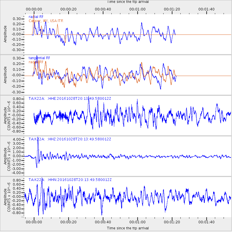
K22A Casper, WY, USA - Earthquake Result Viewer
*The percent match for this event was below the threshold and hence no stack was calculated.
| Earthquake location: |
Tyrrhenian Sea |
| Earthquake latitude/longitude: |
39.3/13.5 |
| Earthquake time(UTC): |
2016/10/28 (302) 20:02:48 GMT |
| Earthquake Depth: |
448 km |
| Earthquake Magnitude: |
5.8 MWW, 5.8 MWB |
| Earthquake Catalog/Contributor: |
NEIC PDE/NEIC COMCAT |
|
| Network: |
TA USArray Transportable Network (new EarthScope stations) |
| Station: |
K22A Casper, WY, USA |
| Lat/Lon: |
42.65 N/106.52 W |
| Elevation: |
1686 m |
|
| Distance: |
82.0 deg |
| Az: |
319.848 deg |
| Baz: |
42.691 deg |
| Ray Param: |
$rayparam |
*The percent match for this event was below the threshold and hence was not used in the summary stack. |
|
| Radial Match: |
59.868927 % |
| Radial Bump: |
400 |
| Transverse Match: |
54.857838 % |
| Transverse Bump: |
400 |
| SOD ConfigId: |
11737051 |
| Insert Time: |
2019-04-25 23:23:36.206 +0000 |
| GWidth: |
2.5 |
| Max Bumps: |
400 |
| Tol: |
0.001 |
|
Signal To Noise
| Channel | StoN | STA | LTA |
| TA:K22A: :HHZ:20161028T20:13:49.580012Z | 10.982551 | 1.4728784E-6 | 1.3411078E-7 |
| TA:K22A: :HHN:20161028T20:13:49.580012Z | 1.7733184 | 4.243346E-7 | 2.3928843E-7 |
| TA:K22A: :HHE:20161028T20:13:49.580012Z | 2.3081656 | 3.7043296E-7 | 1.6048804E-7 |
| Arrivals |
| Ps | |
| PpPs | |
| PsPs/PpSs | |


