You are here: Home > Network List > TA - USArray Transportable Network (new EarthScope stations) Stations List
> Station KSCO Kaye Shedlock's, Cheyenne Wells, CO, USA > Earthquake Result Viewer
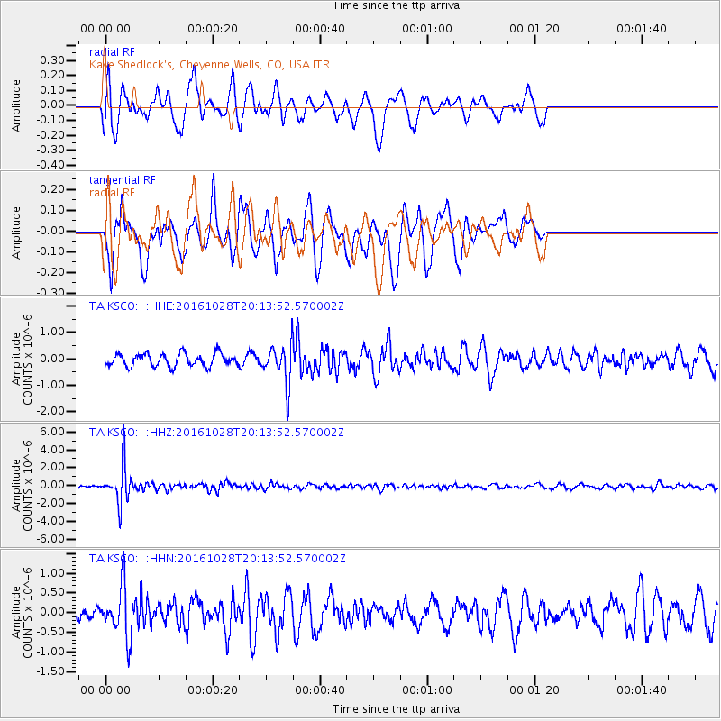
KSCO Kaye Shedlock's, Cheyenne Wells, CO, USA - Earthquake Result Viewer
*The percent match for this event was below the threshold and hence no stack was calculated.
| Earthquake location: |
Tyrrhenian Sea |
| Earthquake latitude/longitude: |
39.3/13.5 |
| Earthquake time(UTC): |
2016/10/28 (302) 20:02:48 GMT |
| Earthquake Depth: |
448 km |
| Earthquake Magnitude: |
5.8 MWW, 5.8 MWB |
| Earthquake Catalog/Contributor: |
NEIC PDE/NEIC COMCAT |
|
| Network: |
TA USArray Transportable Network (new EarthScope stations) |
| Station: |
KSCO Kaye Shedlock's, Cheyenne Wells, CO, USA |
| Lat/Lon: |
39.01 N/102.63 W |
| Elevation: |
1382 m |
|
| Distance: |
82.6 deg |
| Az: |
315.157 deg |
| Baz: |
44.601 deg |
| Ray Param: |
$rayparam |
*The percent match for this event was below the threshold and hence was not used in the summary stack. |
|
| Radial Match: |
51.765102 % |
| Radial Bump: |
400 |
| Transverse Match: |
54.47824 % |
| Transverse Bump: |
323 |
| SOD ConfigId: |
11737051 |
| Insert Time: |
2019-04-25 23:23:39.179 +0000 |
| GWidth: |
2.5 |
| Max Bumps: |
400 |
| Tol: |
0.001 |
|
Signal To Noise
| Channel | StoN | STA | LTA |
| TA:KSCO: :HHZ:20161028T20:13:52.570002Z | 17.556496 | 2.2034455E-6 | 1.2550599E-7 |
| TA:KSCO: :HHN:20161028T20:13:52.570002Z | 2.2044013 | 6.5802004E-7 | 2.9850284E-7 |
| TA:KSCO: :HHE:20161028T20:13:52.570002Z | 3.184121 | 7.437682E-7 | 2.3358668E-7 |
| Arrivals |
| Ps | |
| PpPs | |
| PsPs/PpSs | |


