You are here: Home > Network List > TA - USArray Transportable Network (new EarthScope stations) Stations List
> Station MDND Maddock, ND, USA > Earthquake Result Viewer
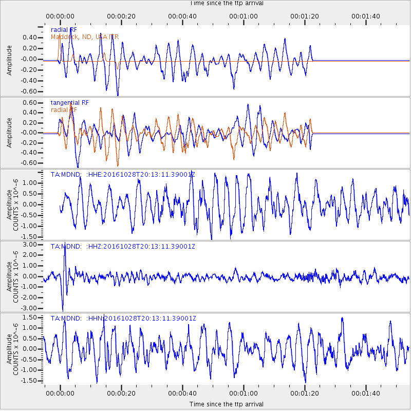
MDND Maddock, ND, USA - Earthquake Result Viewer
*The percent match for this event was below the threshold and hence no stack was calculated.
| Earthquake location: |
Tyrrhenian Sea |
| Earthquake latitude/longitude: |
39.3/13.5 |
| Earthquake time(UTC): |
2016/10/28 (302) 20:02:48 GMT |
| Earthquake Depth: |
448 km |
| Earthquake Magnitude: |
5.8 MWW, 5.8 MWB |
| Earthquake Catalog/Contributor: |
NEIC PDE/NEIC COMCAT |
|
| Network: |
TA USArray Transportable Network (new EarthScope stations) |
| Station: |
MDND Maddock, ND, USA |
| Lat/Lon: |
47.85 N/99.60 W |
| Elevation: |
479 m |
|
| Distance: |
74.9 deg |
| Az: |
320.086 deg |
| Baz: |
47.646 deg |
| Ray Param: |
$rayparam |
*The percent match for this event was below the threshold and hence was not used in the summary stack. |
|
| Radial Match: |
66.31137 % |
| Radial Bump: |
299 |
| Transverse Match: |
59.0406 % |
| Transverse Bump: |
367 |
| SOD ConfigId: |
11737051 |
| Insert Time: |
2019-04-25 23:23:45.581 +0000 |
| GWidth: |
2.5 |
| Max Bumps: |
400 |
| Tol: |
0.001 |
|
Signal To Noise
| Channel | StoN | STA | LTA |
| TA:MDND: :HHZ:20161028T20:13:11.39001Z | 5.107471 | 1.215904E-6 | 2.3806383E-7 |
| TA:MDND: :HHN:20161028T20:13:11.39001Z | 1.941627 | 7.766569E-7 | 4.0000316E-7 |
| TA:MDND: :HHE:20161028T20:13:11.39001Z | 0.88759434 | 4.969722E-7 | 5.599091E-7 |
| Arrivals |
| Ps | |
| PpPs | |
| PsPs/PpSs | |


