
HUMO Hull Mountain, OR - Earthquake Result Viewer
| ||||||||||||||||||
| ||||||||||||||||||
| ||||||||||||||||||
|
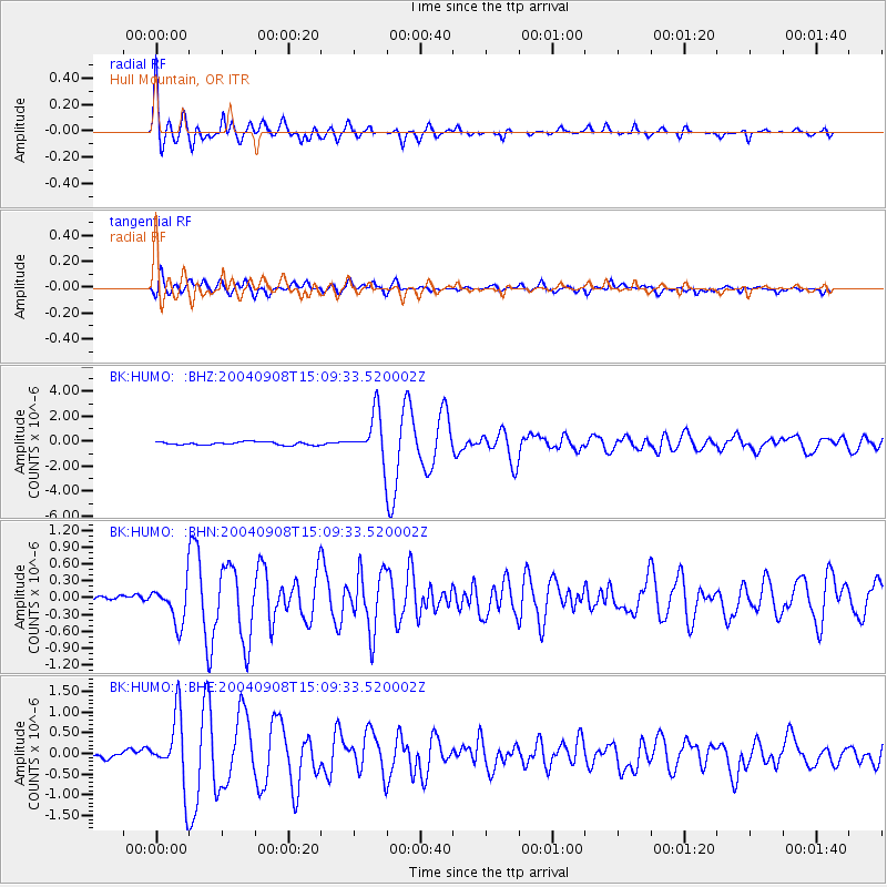
Signal To Noise
| Channel | StoN | STA | LTA |
| BK:HUMO: :BHN:20040908T15:09:33.520002Z | 5.3792853 | 3.4447294E-7 | 6.403693E-8 |
| BK:HUMO: :BHE:20040908T15:09:33.520002Z | 8.418967 | 8.4874483E-7 | 1.00813416E-7 |
| BK:HUMO: :BHZ:20040908T15:09:33.520002Z | 14.2576275 | 1.859258E-6 | 1.3040443E-7 |
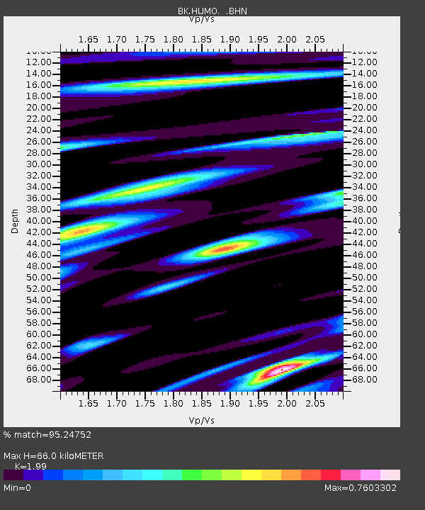
| Arrivals | |
| Ps | 10 SECOND |
| PpPs | 29 SECOND |
| PsPs/PpSs | 40 SECOND |

