HUMO Hull Mountain, OR - Earthquake Result Viewer
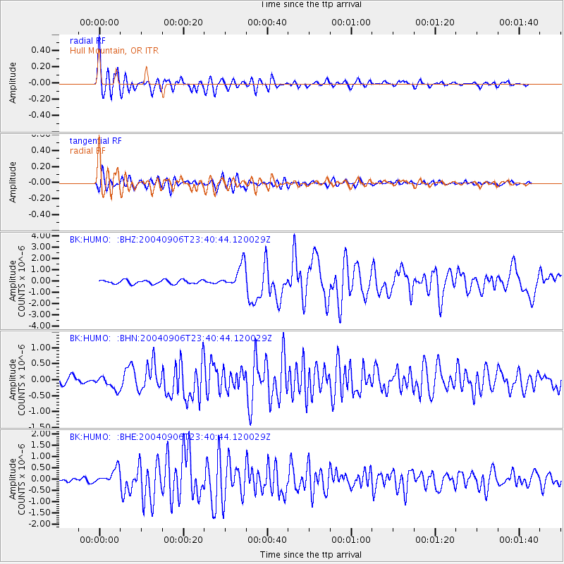
Earthquake location: Near S. Coast Of Honshu, Japan
Earthquake latitude/longitude: 33.2/137.2
Earthquake time(UTC): 2004/09/06 (250) 23:29:35 GMT
Earthquake Depth: 10 km
Earthquake Magnitude: 6.4 MB, 6.3 MS, 6.7 MW, 6.5 MW
Earthquake Catalog/Contributor: WHDF/NEIC
Network: BK Berkeley Digital Seismograph Network
Station: HUMO Hull Mountain, OR
Lat/Lon: 42.61 N/122.96 W
Elevation: 555 m
Distance: 74.8 deg
Az: 48.923 deg
Baz: 301.124 deg
Ray Param: 0.052087255
Estimated Moho Depth: 14.5 km
Estimated Crust Vp/Vs: 1.94
Assumed Crust Vp: 6.522 km/s
Estimated Crust Vs: 3.366 km/s
Estimated Crust Poisson's Ratio: 0.32
Radial Match: 92.06419 %
Radial Bump: 400
Transverse Match: 83.47158 %
Transverse Bump: 400
SOD ConfigId: 2459
Insert Time: 2010-03-05 19:20:44.234 +0000
GWidth: 2.5
Max Bumps: 400
Tol: 0.001

Signal To Noise

ChannelStoNSTALTA
BK:HUMO: :BHN:20040906T23:40:44.120029Z2.35834032.1712987E-79.206892E-8
BK:HUMO: :BHE:20040906T23:40:44.120029Z3.76559143.556078E-79.443611E-8
BK:HUMO: :BHZ:20040906T23:40:44.120029Z6.49602751.1060175E-61.7026059E-7
Arrivals
Ps2.1 SECOND
PpPs6.3 SECOND
PsPs/PpSs8.5 SECOND