
HUMO Hull Mountain, OR - Earthquake Result Viewer
| ||||||||||||||||||
| ||||||||||||||||||
| ||||||||||||||||||
|
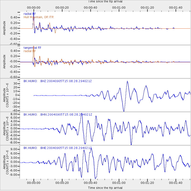
Signal To Noise
| Channel | StoN | STA | LTA |
| BK:HUMO: :BHN:20040905T15:08:28.294021Z | 0.79442316 | 7.216128E-8 | 9.08348E-8 |
| BK:HUMO: :BHE:20040905T15:08:28.294021Z | 2.9141004 | 3.7070305E-7 | 1.2721011E-7 |
| BK:HUMO: :BHZ:20040905T15:08:28.294021Z | 2.8598332 | 4.829945E-7 | 1.6888903E-7 |
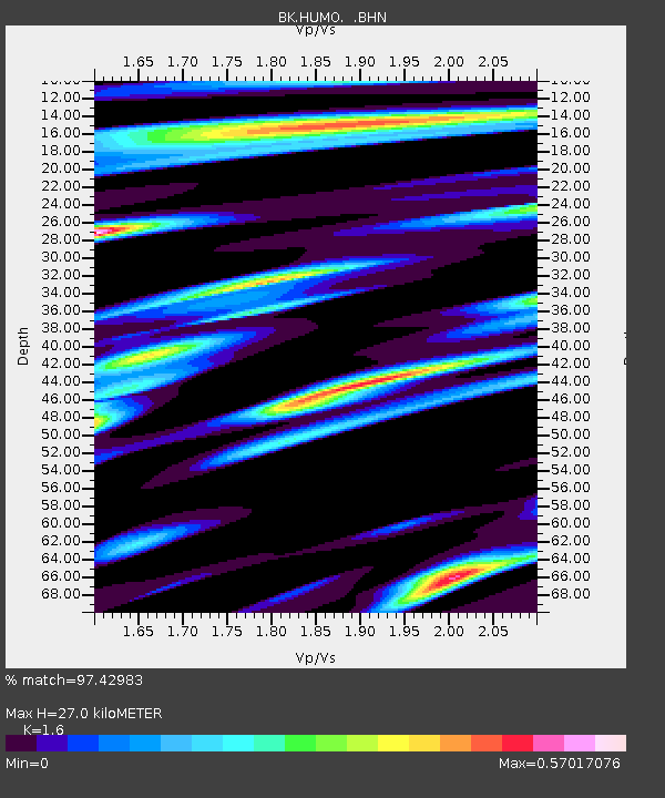
| Arrivals | |
| Ps | 2.6 SECOND |
| PpPs | 10 SECOND |
| PsPs/PpSs | 13 SECOND |

