
HUMO Hull Mountain, OR - Earthquake Result Viewer
| ||||||||||||||||||
| ||||||||||||||||||
| ||||||||||||||||||
|
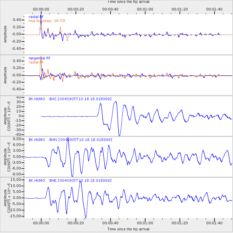
Signal To Noise
| Channel | StoN | STA | LTA |
| BK:HUMO: :BHN:20040905T10:18:18.918999Z | 25.663465 | 2.1227272E-6 | 8.2713974E-8 |
| BK:HUMO: :BHE:20040905T10:18:18.918999Z | 39.291412 | 4.0375758E-6 | 1.02759756E-7 |
| BK:HUMO: :BHZ:20040905T10:18:18.918999Z | 70.91518 | 1.2313569E-5 | 1.7363799E-7 |
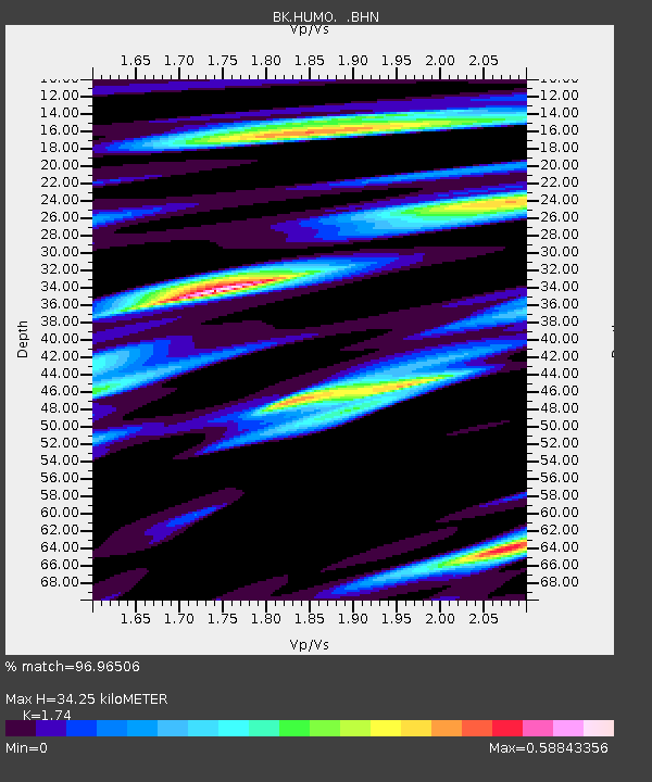
| Arrivals | |
| Ps | 4.0 SECOND |
| PpPs | 14 SECOND |
| PsPs/PpSs | 18 SECOND |

