You are here: Home > Network List > BK - Berkeley Digital Seismograph Network Stations List
> Station HUMO Hull Mountain, OR > Earthquake Result Viewer
HUMO Hull Mountain, OR - Earthquake Result Viewer

| Earthquake location: |
Kermadec Islands Region |
| Earthquake latitude/longitude: |
-31.2/-176.9 |
| Earthquake time(UTC): |
2008/12/09 (344) 06:23:59 GMT |
| Earthquake Depth: |
18 km |
| Earthquake Magnitude: |
6.2 MB, 6.7 MS, 6.8 MW, 6.7 MW |
| Earthquake Catalog/Contributor: |
WHDF/NEIC |
|
| Network: |
BK Berkeley Digital Seismograph Network |
| Station: |
HUMO Hull Mountain, OR |
| Lat/Lon: |
42.61 N/122.96 W |
| Elevation: |
555 m |
|
| Distance: |
88.6 deg |
| Az: |
36.67 deg |
| Baz: |
223.862 deg |
| Ray Param: |
0.042433828 |
| Estimated Moho Depth: |
40.5 km |
| Estimated Crust Vp/Vs: |
1.66 |
| Assumed Crust Vp: |
6.522 km/s |
| Estimated Crust Vs: |
3.935 km/s |
| Estimated Crust Poisson's Ratio: |
0.21 |
|
| Radial Match: |
90.81583 % |
| Radial Bump: |
391 |
| Transverse Match: |
71.39007 % |
| Transverse Bump: |
394 |
| SOD ConfigId: |
2658 |
| Insert Time: |
2010-03-05 19:24:59.363 +0000 |
| GWidth: |
2.5 |
| Max Bumps: |
400 |
| Tol: |
0.001 |
|
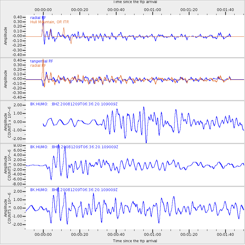
Signal To Noise
| Channel | StoN | STA | LTA |
| BK:HUMO: :BHN:20081209T06:36:20.109009Z | 11.641931 | 2.1897624E-6 | 1.8809273E-7 |
| BK:HUMO: :BHE:20081209T06:36:20.109009Z | 2.950954 | 6.5473E-7 | 2.2187061E-7 |
| BK:HUMO: :BHZ:20081209T06:36:20.109009Z | 1.2562352 | 3.3044583E-7 | 2.6304454E-7 |
| Arrivals |
| Ps | 4.2 SECOND |
| PpPs | 16 SECOND |
| PsPs/PpSs | 20 SECOND |


