
HUMO Hull Mountain, OR - Earthquake Result Viewer
| ||||||||||||||||||
| ||||||||||||||||||
| ||||||||||||||||||
|
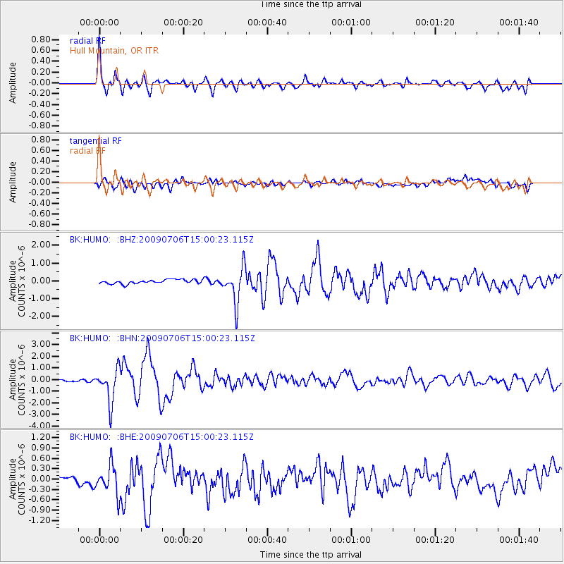
Signal To Noise
| Channel | StoN | STA | LTA |
| BK:HUMO: :BHN:20090706T15:00:23.115Z | 15.4645405 | 1.4966698E-6 | 9.678075E-8 |
| BK:HUMO: :BHE:20090706T15:00:23.115Z | 3.137871 | 4.2580695E-7 | 1.3569931E-7 |
| BK:HUMO: :BHZ:20090706T15:00:23.115Z | 9.183723 | 1.0279349E-6 | 1.1193008E-7 |
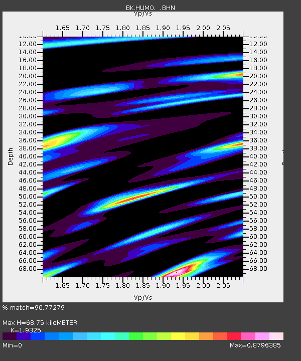
| Arrivals | |
| Ps | 10 SECOND |
| PpPs | 29 SECOND |
| PsPs/PpSs | 39 SECOND |

