You are here: Home > Network List > BK - Berkeley Digital Seismograph Network Stations List
> Station HUMO Hull Mountain, OR > Earthquake Result Viewer
HUMO Hull Mountain, OR - Earthquake Result Viewer
*The percent match for this event was below the threshold and hence no stack was calculated.
| Earthquake location: |
South Of Fiji Islands |
| Earthquake latitude/longitude: |
-25.4/-177.6 |
| Earthquake time(UTC): |
2008/09/01 (245) 04:00:39 GMT |
| Earthquake Depth: |
171 km |
| Earthquake Magnitude: |
5.7 MB, 6.0 MW, 6.0 MW |
| Earthquake Catalog/Contributor: |
WHDF/NEIC |
|
| Network: |
BK Berkeley Digital Seismograph Network |
| Station: |
HUMO Hull Mountain, OR |
| Lat/Lon: |
42.61 N/122.96 W |
| Elevation: |
555 m |
|
| Distance: |
84.3 deg |
| Az: |
37.252 deg |
| Baz: |
227.872 deg |
| Ray Param: |
$rayparam |
*The percent match for this event was below the threshold and hence was not used in the summary stack. |
|
| Radial Match: |
46.632683 % |
| Radial Bump: |
400 |
| Transverse Match: |
45.353985 % |
| Transverse Bump: |
356 |
| SOD ConfigId: |
2504 |
| Insert Time: |
2010-03-05 19:26:33.531 +0000 |
| GWidth: |
2.5 |
| Max Bumps: |
400 |
| Tol: |
0.001 |
|
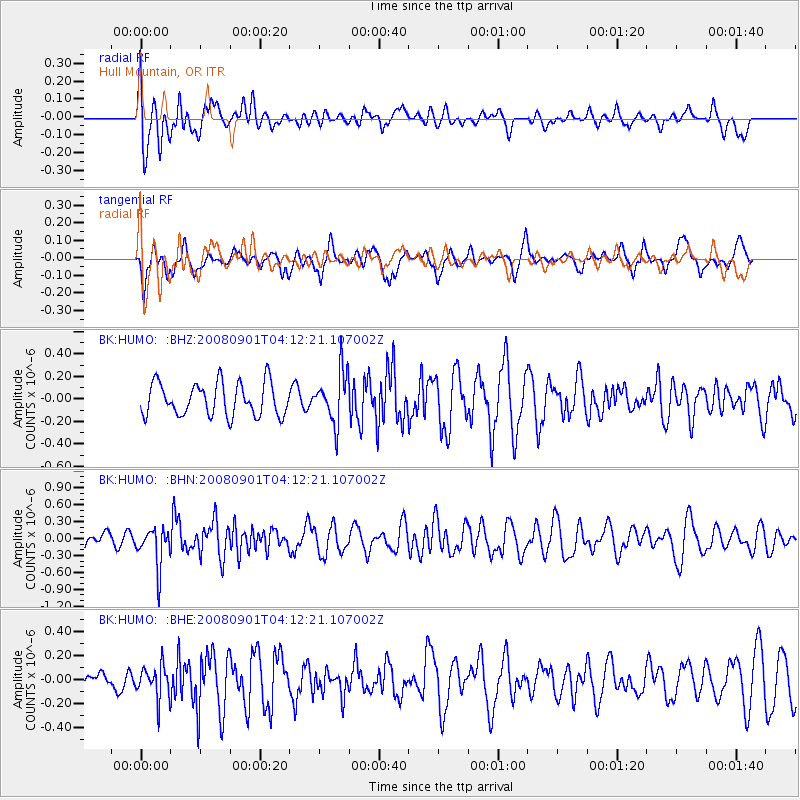
Signal To Noise
| Channel | StoN | STA | LTA |
| BK:HUMO: :BHN:20080901T04:12:21.107002Z | 2.9601076 | 3.483399E-7 | 1.1767813E-7 |
| BK:HUMO: :BHE:20080901T04:12:21.107002Z | 1.413038 | 1.3440669E-7 | 9.511894E-8 |
| BK:HUMO: :BHZ:20080901T04:12:21.107002Z | 1.5693098 | 2.278422E-7 | 1.4518625E-7 |
| Arrivals |
| Ps | |
| PpPs | |
| PsPs/PpSs | |


