You are here: Home > Network List > BK - Berkeley Digital Seismograph Network Stations List
> Station HUMO Hull Mountain, OR > Earthquake Result Viewer
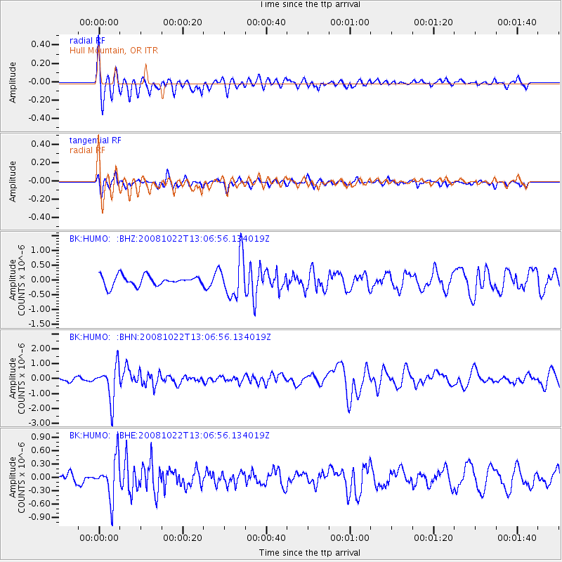
HUMO Hull Mountain, OR - Earthquake Result Viewer
*The percent match for this event was below the threshold and hence no stack was calculated.
| Earthquake location: |
Tonga Islands |
| Earthquake latitude/longitude: |
-18.4/-175.4 |
| Earthquake time(UTC): |
2008/10/22 (296) 12:55:57 GMT |
| Earthquake Depth: |
233 km |
| Earthquake Magnitude: |
5.9 MB, 6.4 MW, 6.3 MW |
| Earthquake Catalog/Contributor: |
WHDF/NEIC |
|
| Network: |
BK Berkeley Digital Seismograph Network |
| Station: |
HUMO Hull Mountain, OR |
| Lat/Lon: |
42.61 N/122.96 W |
| Elevation: |
555 m |
|
| Distance: |
77.5 deg |
| Az: |
36.8 deg |
| Baz: |
230.385 deg |
| Ray Param: |
$rayparam |
*The percent match for this event was below the threshold and hence was not used in the summary stack. |
|
| Radial Match: |
73.137436 % |
| Radial Bump: |
400 |
| Transverse Match: |
47.25549 % |
| Transverse Bump: |
290 |
| SOD ConfigId: |
2556 |
| Insert Time: |
2010-03-05 19:26:40.932 +0000 |
| GWidth: |
2.5 |
| Max Bumps: |
400 |
| Tol: |
0.001 |
|
Signal To Noise
| Channel | StoN | STA | LTA |
| BK:HUMO: :BHN:20081022T13:06:56.134019Z | 7.1900153 | 1.1962154E-6 | 1.6637175E-7 |
| BK:HUMO: :BHE:20081022T13:06:56.134019Z | 2.9670906 | 4.6401857E-7 | 1.5638841E-7 |
| BK:HUMO: :BHZ:20081022T13:06:56.134019Z | 4.1187277 | 6.941972E-7 | 1.685465E-7 |
| Arrivals |
| Ps | |
| PpPs | |
| PsPs/PpSs | |


