You are here: Home > Network List > BK - Berkeley Digital Seismograph Network Stations List
> Station HUMO Hull Mountain, OR > Earthquake Result Viewer
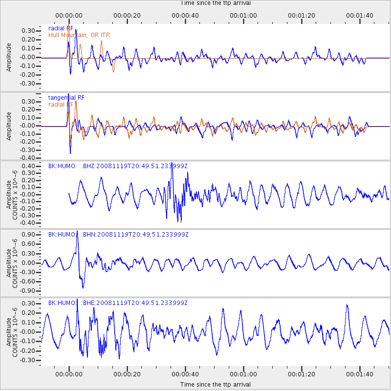
HUMO Hull Mountain, OR - Earthquake Result Viewer
*The percent match for this event was below the threshold and hence no stack was calculated.
| Earthquake location: |
South Of Fiji Islands |
| Earthquake latitude/longitude: |
-22.2/-179.7 |
| Earthquake time(UTC): |
2008/11/19 (324) 20:38:58 GMT |
| Earthquake Depth: |
596 km |
| Earthquake Magnitude: |
5.8 MW, 5.2 MB, 5.8 MW |
| Earthquake Catalog/Contributor: |
WHDF/NEIC |
|
| Network: |
BK Berkeley Digital Seismograph Network |
| Station: |
HUMO Hull Mountain, OR |
| Lat/Lon: |
42.61 N/122.96 W |
| Elevation: |
555 m |
|
| Distance: |
83.0 deg |
| Az: |
38.472 deg |
| Baz: |
231.365 deg |
| Ray Param: |
$rayparam |
*The percent match for this event was below the threshold and hence was not used in the summary stack. |
|
| Radial Match: |
58.48767 % |
| Radial Bump: |
400 |
| Transverse Match: |
45.76823 % |
| Transverse Bump: |
400 |
| SOD ConfigId: |
2658 |
| Insert Time: |
2010-03-05 19:26:56.448 +0000 |
| GWidth: |
2.5 |
| Max Bumps: |
400 |
| Tol: |
0.001 |
|
Signal To Noise
| Channel | StoN | STA | LTA |
| BK:HUMO: :BHN:20081119T20:49:51.233999Z | 5.5150757 | 4.3521112E-7 | 7.8913E-8 |
| BK:HUMO: :BHE:20081119T20:49:51.233999Z | 1.3355867 | 1.3853028E-7 | 1.03722414E-7 |
| BK:HUMO: :BHZ:20081119T20:49:51.233999Z | 1.0579258 | 1.1435906E-7 | 1.0809743E-7 |
| Arrivals |
| Ps | |
| PpPs | |
| PsPs/PpSs | |


