You are here: Home > Network List > BK - Berkeley Digital Seismograph Network Stations List
> Station HUMO Hull Mountain, OR > Earthquake Result Viewer
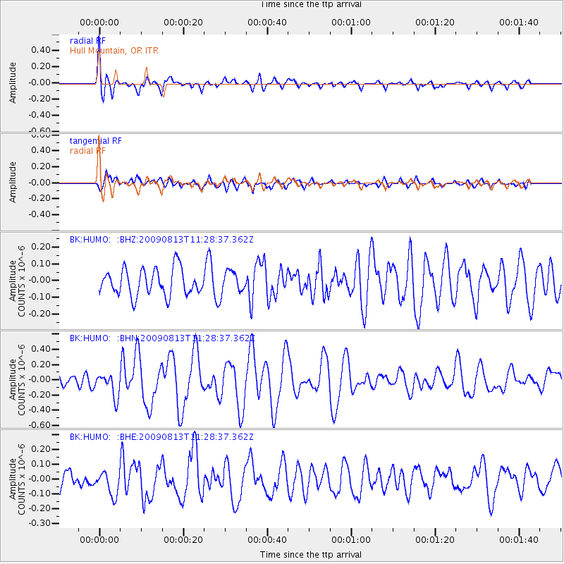
HUMO Hull Mountain, OR - Earthquake Result Viewer
*The percent match for this event was below the threshold and hence no stack was calculated.
| Earthquake location: |
Tonga Islands |
| Earthquake latitude/longitude: |
-21.7/-174.6 |
| Earthquake time(UTC): |
2009/08/13 (225) 11:17:01 GMT |
| Earthquake Depth: |
10 km |
| Earthquake Magnitude: |
5.6 MW, 5.3 MB |
| Earthquake Catalog/Contributor: |
WHDF/NEIC |
|
| Network: |
BK Berkeley Digital Seismograph Network |
| Station: |
HUMO Hull Mountain, OR |
| Lat/Lon: |
42.61 N/122.96 W |
| Elevation: |
555 m |
|
| Distance: |
79.7 deg |
| Az: |
36.025 deg |
| Baz: |
227.822 deg |
| Ray Param: |
$rayparam |
*The percent match for this event was below the threshold and hence was not used in the summary stack. |
|
| Radial Match: |
76.04737 % |
| Radial Bump: |
400 |
| Transverse Match: |
70.9305 % |
| Transverse Bump: |
400 |
| SOD ConfigId: |
2622 |
| Insert Time: |
2010-03-05 19:27:07.375 +0000 |
| GWidth: |
2.5 |
| Max Bumps: |
400 |
| Tol: |
0.001 |
|
Signal To Noise
| Channel | StoN | STA | LTA |
| BK:HUMO: :BHN:20090813T11:28:37.362Z | 2.3298652 | 1.5915253E-7 | 6.830976E-8 |
| BK:HUMO: :BHE:20090813T11:28:37.362Z | 1.711256 | 8.0744215E-8 | 4.718418E-8 |
| BK:HUMO: :BHZ:20090813T11:28:37.362Z | 0.7594633 | 5.973358E-8 | 7.8652356E-8 |
| Arrivals |
| Ps | |
| PpPs | |
| PsPs/PpSs | |


