You are here: Home > Network List > BK - Berkeley Digital Seismograph Network Stations List
> Station HUMO Hull Mountain, OR > Earthquake Result Viewer
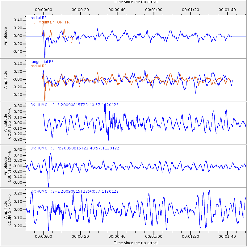
HUMO Hull Mountain, OR - Earthquake Result Viewer
*The percent match for this event was below the threshold and hence no stack was calculated.
| Earthquake location: |
Fiji Islands Region |
| Earthquake latitude/longitude: |
-19.8/-178.2 |
| Earthquake time(UTC): |
2009/08/15 (227) 23:30:19 GMT |
| Earthquake Depth: |
608 km |
| Earthquake Magnitude: |
5.6 MW, 5.2 MB |
| Earthquake Catalog/Contributor: |
WHDF/NEIC |
|
| Network: |
BK Berkeley Digital Seismograph Network |
| Station: |
HUMO Hull Mountain, OR |
| Lat/Lon: |
42.61 N/122.96 W |
| Elevation: |
555 m |
|
| Distance: |
80.3 deg |
| Az: |
37.998 deg |
| Baz: |
231.726 deg |
| Ray Param: |
$rayparam |
*The percent match for this event was below the threshold and hence was not used in the summary stack. |
|
| Radial Match: |
63.034454 % |
| Radial Bump: |
400 |
| Transverse Match: |
67.217705 % |
| Transverse Bump: |
400 |
| SOD ConfigId: |
2622 |
| Insert Time: |
2010-03-05 19:27:08.346 +0000 |
| GWidth: |
2.5 |
| Max Bumps: |
400 |
| Tol: |
0.001 |
|
Signal To Noise
| Channel | StoN | STA | LTA |
| BK:HUMO: :BHN:20090815T23:40:57.112012Z | 3.6766772 | 3.1311555E-7 | 8.516265E-8 |
| BK:HUMO: :BHE:20090815T23:40:57.112012Z | 0.8376312 | 7.526709E-8 | 8.9857075E-8 |
| BK:HUMO: :BHZ:20090815T23:40:57.112012Z | 1.5052011 | 1.454109E-7 | 9.6605625E-8 |
| Arrivals |
| Ps | |
| PpPs | |
| PsPs/PpSs | |


