You are here: Home > Network List > BK - Berkeley Digital Seismograph Network Stations List
> Station HUMO Hull Mountain, OR > Earthquake Result Viewer
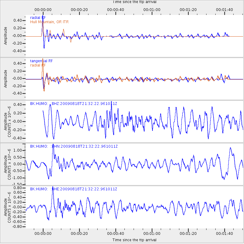
HUMO Hull Mountain, OR - Earthquake Result Viewer
*The percent match for this event was below the threshold and hence no stack was calculated.
| Earthquake location: |
South Of Fiji Islands |
| Earthquake latitude/longitude: |
-26.1/-178.4 |
| Earthquake time(UTC): |
2009/08/18 (230) 21:20:47 GMT |
| Earthquake Depth: |
270 km |
| Earthquake Magnitude: |
5.5 MB, 6.3 MW, 6.3 MW |
| Earthquake Catalog/Contributor: |
WHDF/NEIC |
|
| Network: |
BK Berkeley Digital Seismograph Network |
| Station: |
HUMO Hull Mountain, OR |
| Lat/Lon: |
42.61 N/122.96 W |
| Elevation: |
555 m |
|
| Distance: |
85.3 deg |
| Az: |
37.59 deg |
| Baz: |
228.004 deg |
| Ray Param: |
$rayparam |
*The percent match for this event was below the threshold and hence was not used in the summary stack. |
|
| Radial Match: |
62.015102 % |
| Radial Bump: |
400 |
| Transverse Match: |
52.22232 % |
| Transverse Bump: |
400 |
| SOD ConfigId: |
2622 |
| Insert Time: |
2010-03-05 19:27:10.158 +0000 |
| GWidth: |
2.5 |
| Max Bumps: |
400 |
| Tol: |
0.001 |
|
Signal To Noise
| Channel | StoN | STA | LTA |
| BK:HUMO: :BHN:20090818T21:32:22.961011Z | 1.9915111 | 5.051271E-7 | 2.536401E-7 |
| BK:HUMO: :BHE:20090818T21:32:22.961011Z | 1.9740863 | 2.2945319E-7 | 1.16232606E-7 |
| BK:HUMO: :BHZ:20090818T21:32:22.961011Z | 0.93110883 | 1.5892158E-7 | 1.7067991E-7 |
| Arrivals |
| Ps | |
| PpPs | |
| PsPs/PpSs | |


